Field Activity 2002-053-FA

Identifier 2002-053-FA
Alternate names PASTA Leg 3
Purpose 
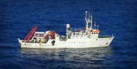
Deploy EuroSTRATAFORM tripods (moorings #701, 702 and 703); assist others with seabed and water column sampling; USGS thermistors deployed by Cacchione and Puig (mooring #700).
Location Chienti River, Civitinova, Italy, Adriatic Sea, Mediterranean Sea, Europe, North Atlantic;
Summary Heavy fishing pressure - extra guard buoys. Leg 3 moorings deployed: 3 (#701, 702 and 703 all recovered FA 03011 SEWARD JOHNSON Feb. 11-22, 2003). Cruise Legs 1, 2 and 3 Summary: 24 Oct. - loaded ship in Ravenna. 25-28 Oct. - Leg 1a (UW, ICM, OSU, IGM), 2 tripods, 1 mooring and 6 guard buoys were deployed near Po and Pescara; seabed coring and water column profiling occurred at night. 28 Oct. - 4 Nov. - Leg 1b (UW, IGM, OSU, ICM), seabed coring and water column profiling extended from Gargano to Po. 5-7 Nov. - Leg 2 (WHOI, IGM, ICM, UW), 4 tripods and 6 guard buoys were deployed near the Po and Ravenna; water column profiling occurred at night. 7-13 Nov. - Leg 3 (USGS, IGM, Dalhousie, WHOI, ICM), 3 tripods and 4 guard buoys were deployed near the Chienti; water-column profiling extended from Gargano to Po. 14 Nov. - unloaded ship in Ravenna.
Info derived Time series data; Grain size analysis; Suspended sediment concentrations;
Comments Original Center People field contained: Christopher Sherwood - Chief Scientist, tripod scientist (Leg 3); Jonathan Borden - technician (Leg 2 only). Project = EuroSTRATAFORM, EuroSTRATAFORM
URL
Platform
Garcia Del Cid
37.2M
Itinerary
Start Ravenna, Italy 2002-11-07
End Ravenna, Italy 2002-11-13
Days in the field 14
Bounds
West 13.2056
East 14.93815104
North 44.95848179
South 41.9662442

Personnel

Organization
384 Woods Hole Road
Quissett Campus
Woods Hole, MA02543-1598
(508) 548-8700
Principal investigators Christopher R Sherwood
Crew members
Christopher R Sherwood
Scientist, Staff
Jonathan Borden
Scientist, Staff
Information specialist(s)
Frances L Lightsom
Specialist, Information
Affiliate principal Chuck Nittrouer, UW; Rocky Geyer, WHOI; Paul Hill, Dalhousie
Affiliate staff Joanne Ferreira - technician (Leg 3); Dave Rubin - camera scientist (Leg 3); Scientists and technicians from 12 institutions

Data types and categories

Data category: Environmental Data, Location-Elevation, Sampling, Time Series
Data type: CTD, Current, Temperature, Navigation, Biology, Geology, Mooring (physical oceanography)

Moorings

RCV:; DEP: 701, 702, 703;

Equipment used

Equipment Usage description Data types Datasets
Kasten corer Geology (no data reported)
SBE 9 CTD CTD (no data reported)
DGPS Navigation (no data reported)
Bottom platform Mooring (physical oceanography) 1
Temperature and salinity CTD, Temperature (no data reported)
Pressure Mooring (physical oceanography) (no data reported)
Turbidity Mooring (physical oceanography) (no data reported)
Current Mooring (physical oceanography) (no data reported)
ADCP Current (no data reported)
Box corer Biology, Geology (no data reported)

Datasets

Datasets produced in this activity

Dataset name Equipment Description Dataset contact
2002-053-FA-OM-001 Bottom platform mooring data Ellyn Montgomery

Publications

Samples collected during this field activity