| Identifier | 2004-010-FA | ||||||||
|---|---|---|---|---|---|---|---|---|---|
| Alternate names | FSTR0401 | ||||||||
| Purpose | Habitat studies and mapping. | ||||||||
| Location | Stellwagen Bank, Gulf of Maine, Massachusetts, United States, North America, North Atlantic; | ||||||||
| Summary | 37 video/photo transects; 12 invertebrate biology samples; 6 grain-size analysis samples. | ||||||||
| Info derived | Grain size analysis; Habitat maps; Benthic invertebrate analysis; | ||||||||
| Comments | UPDATED June 9, 2004: Mobe at WHOI on Sunday, June 20. Demobe at WHOI on Saturday morning, June 26. Original Center People field contained: Page Valentine, Dann Blackwood, Sarah Fuller, Chuck Worley (for mobe and demobe). Project = SBNMS Habitat Mapping, SBNMS Habitat Mapping Information from Foghorn: center equipment Navigation - P-code; SEABOSS; Smith-Macintyre grab, U. Maine | ||||||||
| URL | |||||||||
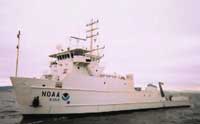
| Platform |
|
||||||||
| Itinerary |
|
||||||||
| Bounds |
|
| Organization |
384 Woods Hole Road
Quissett Campus
Woods Hole, MA02543-1598
(508) 548-8700
|
||||||||
|---|---|---|---|---|---|---|---|---|---|
| Principal investigators | Page C Valentine | ||||||||
| Crew members |
|
||||||||
| Information specialist(s) |
|
||||||||
| Affiliate principal | James Lindholm, SBNMS | ||||||||
| Affiliate staff | Kari Heinonen, UCONN, biologist; Betsy Grannis, U. Maine, biologist |
| Data category: | Biological Field Study, Imagery, Location-Elevation, Sampling, Visual Identification |
|---|---|
| Data type: | Experiments (biological), Surveys (biological), Photo, Video, Navigation, Biology, Geology, Species ID |
| Equipment | Usage description | Data types | Datasets |
|---|---|---|---|
| SeaBOSS | Surveys (biological), Experiments (biological), Species ID, Photo, Video, Geology, Biology | 9 | |
| Grab sampler | Biology, Geology | (no data reported) | |
| P-code GPS | Navigation | (no data reported) | |
| Digital camera | Photo | 1 | |
| Smith-MacIntyre grab | Biology, Geology | (no data reported) |
| Dataset name | Equipment | Description | Dataset contact |
|---|---|---|---|
| 2004-010-FA-PH-001 | SeaBOSS | CD ROM disk of BOTTOM PHOTO STELL | Nancy K. Soderberg |
| 2004-010-FA-SC-001 | SeaBOSS | grab samples | Brian Buczkowski |
| 2004-010-FA-PH-002 | Digital camera | Deck photos of field activity operations | Dann S Blackwood |
| Dataset name | Equipment | Description | Dataset contact |
|---|---|---|---|
| Stellwagen_sedimentsamples | SeaBOSS | Geographic locations of seabed sediment samples from the Stellwagen Bank National Marine Sanctuary Region. Includes sediment analyses. | Page C Valentine |
| ridges0_SIM2840 | SeaBOSS | Boulder ridges less than 1 m high on the sea floor of the Stellwagen Bank National Marine Sanctuary region. The boulder ridges were identified using multibeam topographic imagery and backscatter intensity of the seabed and video and photographic images collected from 1994 to 2003. | Page C Valentine |
| ridges1_SIM2840 | SeaBOSS | Boulder ridges greater than or equal to 1 m high on the sea floor of the Stellwagen Bank National Marine region. The boulder ridges were identified using multibeam topographic imagery and backscatter intensity of the seabed and video and photographic images collected from 1994 to 2003. | Page C Valentine |
| sbnmsallsta_SIM2840 | SeaBOSS | Sample and video stations located in the Stellwagen Bank National Marine Sanctuary region. Stations represent the location of a sediment sample and/or the end of a video transect. | Page C Valentine |
| sbnmsallvid_SIM2840 | SeaBOSS | Video transects of the sea floor in the Stellwagen Bank National Marine Sanctuary region. This dataset contains polylines showing extents of video transects documenting seabed characteristics in the Stellwagen Bank National Marine Sanctuary Region off Boston, Massachusetts, an area of approximately 1100 nautical square miles. | Page C Valentine |
| SIM3341_stations_geology | SeaBOSS | Point shapefile of quadrangle 6 station locations in Stellwagen Bank National Marine Sanctuary offshore of Boston, Massachusetts where video, photographs and sediment samples were collected by the U.S. Geological Survey from 1993-2004 - includes sediment sample analyses and interpreted geologic substrate. | Page C Valentine |
| SIM3341_geologic_interp | SeaBOSS | Polygon shapefile of the interpretation of the seabed geologic substrates in quadrangle 6 of the Stellwagen Bank National Marine Sanctuary region offshore of Boston, Massachusetts based on data collected by the U.S. Geological Survey from 1993-2004 | Page C Valentine |