Field Activity 2004-016-FA

Identifier 2004-016-FA
Alternate names MH44-04
Purpose Exchange moorings at the Boston B Buoy. Recover moorings at the site off Scituate. On the second day, collect sediment cores and sediment-oxygen profiles at Stations 2 and 3.
Location Massachusetts Bay, Massachusetts, United States, North America, North Atlantic,
Summary 
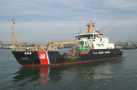
This cruise was conducted in cold (20 degrees F) winds from the west (20-25 kts) on Day 1 and in snow, sleet and freezing rain on Day 2 (20 kts SE). The ship continues to be a major factor in the success of this operation. The scientific and ship crews worked hard and well together, as usual. Moorings deployed: 2 (#755 and 756 both recovered FA 04026 MARCUS HANNA May 19-20, 2004). Moorings recovered: 2 (#716 and 718 both deployed FA 03043 MARCUS HANNA Sep. 24-25, 2003). At Station A (near the Boston B Buoy) the subsurface mooring was exchanged and a refurbished large tripod was deployed. The tripod deployed in September did not come up. At Scituate, the NOPP subsurface mooring #734 (deployed FA 03057 CHRISTOPHER ANDREW Aug. 27, 2003) was recovered. The tripod did not come up. Divers will be scheduled to help recover instruments at both locations in the near future. Coring was successful at both Stations 3 and 2. One core was given to Joseph Smith at U. Mass. Boston for analysis of Iodine 131 and others to our WHOI colleagues for analysis of pore water. Other cores were returned to USGS for X-rays and analysis of texture, metals, Th234, etc.
Info derived Time series data; Samples and chemical analysis; Grain size analysis; Suspended sediment concentrations;
Comments Original Center People field contained: USGS scientists on board: Sandy Baldwin, Dann Blackwood, Jonathan Borden, Mike Bothner, Michael Casso, Dirk Koopmans, Marinna Martini, Stephen Ruane. Project = The Massachusetts Bay Experiment, The Massachusetts Bay Experiment
URL
Platform
Marcus Hanna
175 feet long. Buoy tender.
Itinerary
Start Coast Guard Base, Boston, MA 2004-02-05
End Coast Guard Base, Boston, MA 2004-02-06
Days in the field 2
Bounds
West -70.9167
East -70.58333
North 42.41667
South 42.13333

Personnel

Organization
384 Woods Hole Road
Quissett Campus
Woods Hole, MA02543-1598
(508) 548-8700
Principal investigators Michael Bothner
Crew members
Michael Bothner
Scientist, Staff
Michael Casso
Scientist, Staff
Sandy Baldwin
Scientist, Staff
Dann S Blackwood
Scientist, Staff
Marinna A Martini
Scientist, Staff
Jonathan Borden
Scientist, Staff
Koopmans, Dirk
Scientist, Staff
Ruane, Stephen
Scientist, Staff
Information specialist(s)
Frances L Lightsom
Specialist, Information
Michael Casso
Specialist, Information
Affiliate staff WHOI scientist on board: Joanne Goudreau; MWRA scientist: Douglas Hersh

Data types and categories

Data category: Environmental Data, Imagery, Location-Elevation, Sampling
Data type: CTD, Dissolved Oxygen, Temperature, Photo, Video, Navigation, Geology

Moorings

RCV: 716, 718, 734; DEP: 755, 756;

Equipment used

Equipment Usage description Data types Datasets
Oxygen profiling system from Sayles Dissolved Oxygen (no data reported)
Video camera - deep sea Video (no data reported)
Van Veen grab sampler Geology (no data reported)
Temperature and salinity CTD, Temperature 1
Slow corer Geology (no data reported)
Digital camera Photo 1
DGPS Navigation (no data reported)

Datasets

Datasets produced in this activity

Dataset name Equipment Description Dataset contact
2004-016-FA-OM-001 Temperature and salinity Western Mass Bay mooring data Ellyn Montgomery
2004-016-FA-PH-001 Digital camera Deck photos of field activity operations Dann S Blackwood

Publications

Samples collected during this field activity