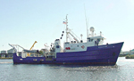
Collect bottom camera and electrical resistivity data across two possible gas hydrate mounds in the Mississippi Canyon, northern Gulf of Mexico, as part of a site survey for the JIP/DOE Gas Hydrates Drilling Program.
Location
Atwater Valley, Mississippi Canyon, Gulf of Mexico, North America, North Atlantic;
Summary
This was a successful cruise with 5973 bottom images collected on four tows; the EM data fulfilled the objective of showing proof of concept for the system (17 km on 9 lines).
Comments
This is a follow-up cruise to G1-03-GM (WH field activity 03001). This cruise is only at the Atwater Valley site in the Mississippi Canyon. The bottom camera work is the USGS portion (contracted to WHOI). The bottom resistivity is not USGS, but is part of the larger gas hydrates program in the northern Gulf of Mexico. Original Center People field contained: Lauren Gilbert - watch; John Evans - watch, camera navigation.
Project = USGS Gas Hydrates, USGS Gas Hydrates
Rob Evans, WHOI - chief sci.; Dan Fornari, WHOI - camera scientist; Mike Boyle, USGS-MP - navigation, tech. support; Marshall Swartz, WHOI - camera tech.; Alan Gardner, WHOI - EM tech.; Jennifer Dougherty, USGS-MP - watch, GIS