| Summary |
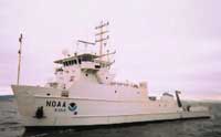
Survey dates: 16-20 October 2005. Area of survey: Inner continental shelf from Charleston to Myrtle Beach, South Carolina. The equipment arrived in Charleston on October 15, and was installed on the ship and tested. All was in good working order with the exception of the depth sounder. Due to the size of the boat it was not possible to install the depth sounder head. The ship left the NOAA pier at 10 a.m. Sunday, October 17 to steam to the first survey site. Upon arriving on site and powering the survey gear it was found that the Lowrance GPS unit had failed. Because the navigation information is an integral part of the survey, Emile Bergeron attempted to feed the navigation string that was being supplied by the bridge into the SuperSting resistivity logging unit. This caused the SuperSting unit to behave in a very bizarre way. The navigation information being supplied was so garbled that it caused all data and configuration files in the unit to be overwritten with random characters. It took several hours to figure out what the root of the problem was. Once solved, the SuperSting unit was set up to operate without a navigation feed, and navigation data were logged remotely on a laptop. It was determined after the fact that during these adjustments the bad navigation string had caused the clock to reset to midnight, January 2, 2000. Survey lines L1 through L5 had this time offset. Navigation continued to be a problem when HYPACK stopped recognizing the navigation information. The sonar technician from Coastal Carolina University set up an Ashtech GPS unit and this data was then fed to both HYPACK and the SuperSting logging computer. The time and date on the SuperSting unit were reset to GMT at this point. The survey continued without any major difficulties with the exception of battery power for the resistivity equipment. Since surveying was being done around the clock, the batteries used to power the SuperSting unit never had time to properly charge causing the unit to shut down, sometimes after only a minute of surveying. Batteries from the ship and those brought by Coastal Carolina were brought into use in an attempt to keep going. An insufficient number of battery chargers, however, made it a battle of diminishing returns. In the end 10 batteries were being used, all with questionable charge status. Upon returning to Woods Hole, Emile Bergeron called Lowrance about the failed GPS head and was informed by them that the particular unit used would fail if placed too close to a radar unit. The head as installed on the ship was no closer than 30 feet to the ship's radar. Lowrance has repaired this problem and will replace our unit. All the navigation files that were logged remotely had to be converted from $GPGGA to $GPRMC as the AGI software will only recognize $GPRMC. This was a tedious process, especially for the files that were logged using the ship's navigation, as the files contained not only $GPGGA but GPZDA, GPZTG, GPGGL, GPGSV, GPVTG, GPZDA, and GPBWC. The files were also corrupt which made editing them all the more difficult. The survey consisted of two long shore-parallel lines with several shorter crossing lines, and a small grid further offshore. A total of 326 km of continuous resistivity profiling survey lines were collected, with a minimum line length of 89 meters and a long line of 13,398 meters. That includes 58 lines over 900 meters long. The small mosaic area lines in the offshore area where wells have been previously installed by Billy Moore (Univ. of South Carolina, emeritus) were all about 1000 meters long, but data quality was low. Note that CCU scientists collected seismic data simultaneously. USGS was not involved in collecting or processing these data. A post-cruise meeting to review processed resistivity results took place in Woods Hole on January 10-11, 2006. In attendance were Paul Gayes and Rich Viso from CCU, and John Bratton, VeeAnn Cross, and Wayne Baldwin from USGS. |