Radon mapping and discrete water sampling in West Falmouth Harbor corroborated by infrared fly-over to detect low-temperature groundwater discharge organized with collaborator Ann Giblin, MBL.
Location
West Falmouth Harbor, Snug Harbor, Falmouth, Buzzards Bay, Massachusetts, United States, North America, North Atlantic;
Summary
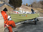
Mapping of water-column radon activity throughout all of West Falmouth Harbor took place on two consecutive days on August 9 and 10, each time covering a large portion of the harbor during a low spring tide and with the same equipment setup as on July 7. No discrete radon samples were collected during this field effort, but 15 water-column samples were collected and filtered for later radium analyses using a bilge pump to pull water into containers carried aboard an MBL owned and operated boat. This event was coordinated with simultaneous thermal imaging conducted from a small aircraft (carried out during the afternoon of August 10 by scientists from the EPA Narragansett Bay lab).
Comments
Related field activities: http://quashnet.er.usgs.gov/data/2006/06020/, http://quashnet.er.usgs.gov/data/2006/06021/, http://quashnet.er.usgs.gov/data/2006/06025/, http://quashnet.er.usgs.gov/data/2006/06037/. Original Center People field contained: Dirk Koopmans; Laura Erban; Max Nepstad; Diomaris Padilla; John Crusius; Dann Blackwood (TERRAPIN driver).
Project = Ground water coastal aquifers, Ground water coastal aquifers