| Summary |
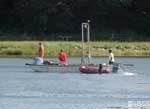
4 cores were collected at the following stations: Station 3, Latitude 41 50.1171, Longitude 69 58.2639; Station 4, Latitude 41 50.1490, Longitude 69 58.3307; Station 2, Latitude 41 50.0174, Longitude 69 58.1467; Station 6, Latitude 41 49.8340, Longitude 69 57.8076. A total of 63 sediment samples were collected at 30-cm intervals from the four cores. Cores were collected in aluminum casing (irrigation pipe) and split, described, photographed, sampled, and discarded in the field. Porewater was extracted from cores for salinity measurement by refractometer in the lab. Samples were also processed for grainsize and two radiocarbon analyses. Data including core description table and core images were included in an open-file report along with electrical resistivity data from the area collected in 2004 and 2006 and groundwater data from 2005. Results, primarily from one core, were presented at the NEGSA meeting in Durham, NH in March 2007. Abstract: HOLOCENE SEDIMENTATION IN A KETTLE POND BREACHED BY RISING SEA LEVEL ON CAPE COD BRATTON, John F., Coastal and Marine Geology Program, U.S. Geological Survey, 384 Woods Hole Rd, Woods Hole, MA 02543-1598, A sediment coring study was performed in a former kettle pond located at Cape Cod National Seashore that is connected to a larger estuary via a narrow channel. The longest core (607 cm) collected near the center of the pond (water depth approximately 9 m) recovered glacial sand and gravel directly overlain by 115 cm of fine-grained lacustrine sediments, and 257 cm of estuarine sediments. Given the shallow depth of the connecting channel, the thickness of the estuarine deposits relative to the lacustrine deposits (> twice as thick) was unexpected, as the pond would have only been breached within the last 2,000 years based on published sea-level curves for the region. The fresh kettle pond, however, would have likely existed for about 15,000 yrs prior to the marine invasion. This pattern suggests that either, 1) estuarine sedimentation rates are much higher than lacustrine sedimentation rates in breached kettle ponds, or 2) the breaching took place earlier than would be expected by modern sill elevations relative to sea level. Other drowned kettle depressions that are completely filled with fine-grained estuarine and marine sediments are known from Cape Cod, consistent with the first scenario. Land use changes could also have increased sedimentation rates within the last few centuries. The second scenario, however, could only be distinguished from the first by development of core chronologies using radiocarbon dating, and would not rule out the possibility of multiple episodes of breaching. More detailed studies of sediments in other breached or drowned kettle depressions will be necessary to determine how common this pattern of sedimentation might be in other formerly glaciated coastal settings. Similar kettle depressions may preserve other sediment transitions from lacustrine to estuarine that could complement sea-level reconstructions based on salt marsh peats, as well as serving as archives of major coastal storms. The nature of the fill in such depressions also has important implications for coastal construction and dredging, as well as for investigations of coastal hydrogeology and submarine groundwater discharge. |