| Identifier | 2007-015-FA | ||||||||
|---|---|---|---|---|---|---|---|---|---|
| Purpose | Geophysical survey of Oyster Pond. | ||||||||
| Location | Oyster Pond, Falmouth, Massachusetts, United States, North America; | ||||||||
| Summary | 10 Kilometers of sidescan and sub-bottom data were collected. | ||||||||
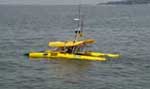
| Platform |
|
||||||||
| Itinerary |
|
||||||||
| Bounds |
|
| Organization |
384 Woods Hole Road
Quissett Campus
Woods Hole, MA02543-1598
(508) 548-8700
|
||||||||||
|---|---|---|---|---|---|---|---|---|---|---|---|
| Principal investigators | Thomas F O'Brien | ||||||||||
| Crew members |
|
||||||||||
| Information specialist(s) |
|
||||||||||
| Affiliate principal | Jeff Donnelly, WHOI | ||||||||||
| Affiliate staff | Jeff Donnelly, Woods Hole Oceanographic Institution |
| Data category: | Seismics, Location-Elevation |
|---|---|
| Data type: | Boomer, Navigation |
| Equipment | Usage description | Data types | Datasets |
|---|---|---|---|
| Boomer | Boomer | (no data reported) | |
| Real Time Kinematic GPS | Navigation | (no data reported) |