Map distributions of shell-bed habitat adjacent to point-associated shoals.
Location
Long Island Sound, New York, Connecticut, United States, North America, North Atlantic,
Summary
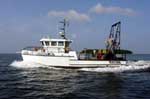
Cruise was conducted in concert with the Teacher Research Experience Program; five middle-high school teachers and two students participated. Bottom photography/sampling stations were occupied in support of three projects: 1) Roanoke and Herod Points - 23 stations - study of shellbed composition and distribution adjacent to shore-attached, cape-associated shoals; 2) Charles Island Shoal - 18 stations - habitat variability appraisal for Ron Goldberg (NMFS-Milford); and 3) East Shoal - 6 stations - investigation of sessile forms on an isolated rocky bathymetric high east of Stratford Shoal for Peter Auster (NURC-NOAA).
This cruise is affiliated with and partly supported by the NURC Teacher-Research Experience (TRE) Program. Program sponsers include the Connecticut Department of Environmental Protection, Connecticut Sea Grant, and the University of Connecticut. Original Center People field contained: Larry Poppe; Dann Blackwood, photographer and SEABOSS tech.