| Identifier | 2008-007-FA | ||||||||
|---|---|---|---|---|---|---|---|---|---|
| Alternate names | T-1-08-LI | ||||||||
| Purpose | Continuous resistivity profiling and geochemical sampling. | ||||||||
| Location | Great South Bay, Manhasset Bay, Northport Harbor, Long Island, Long Island Sound, New York, Connecticut, United States, North America, North Atlantic; | ||||||||
| Summary | Collected resistivity data and geochemical samples to identify sites and rates of submarine groundwater discharge (SGD) to the coastal ocean. Data gathered included resistivity profiles, ground water and surface water geochemical data (temperature and salinity) and samples to be analyzed for nutrients, radioisotopes, and trace metals. | ||||||||
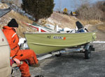
| Comments | Work is funded by multiple tasks within Coastal Groundwater Systems project. Original Center People field contained: Bratton, planning and oversight, CRP; Crusius, planning and oversight, radioisotopes; Kroeger, planning and oversight, nutrient biogeochemistry; Worley, CRP operations; Cross, CRP navigation and GIS; Green, boat driving and tech support; Baldwin, tech support; Erban, tech support; Casso, tech support; Ruppel, stationary resistivity. Project = Characterizing Sub. - South Bay, Characterizing Sub. - South Bay | ||||||||
| Related activities |
2008-020-FA: Project |
||||||||
| Platform |
|
||||||||
| Itinerary |
|
||||||||
| Bounds |
|
| Organization |
384 Woods Hole Road
Quissett Campus
Woods Hole, MA02543-1598
(508) 548-8700
|
||||||||||||||||||||
|---|---|---|---|---|---|---|---|---|---|---|---|---|---|---|---|---|---|---|---|---|---|
| Principal investigators | John F Bratton | ||||||||||||||||||||
| Crew members |
|
||||||||||||||||||||
| Information specialist(s) |
|
| Data category: | Sonar, Electro-Magnetic, Environmental Data, Geochemical, Imagery, Location-Elevation |
|---|---|
| Data type: | Single Beam, Resistivity, Conductivity, Current, Radon, Surveys (geochemical), Photo, Navigation |
| Equipment | Usage description | Data types | Datasets |
|---|---|---|---|
| Lowrance 480M | Navigation, Single Beam | (no data reported) | |
| GPS (wh) | Navigation | (no data reported) | |
| Piezometer | Conductivity | (no data reported) | |
| RAD7 radon detection instrument | Radon | (no data reported) | |
| Seepage meters | Current | (no data reported) | |
| AGI SuperSting | Resistivity | 6 | |
| Submersible pumps | Surveys (geochemical) | (no data reported) | |
| Digital camera | Photo | (no data reported) |
| Dataset name | Equipment | Description | Dataset contact |
|---|---|---|---|
| 2008-007-FA-NL-007 | AGI SuperSting | Logs for RAW CRP, | Nancy K. Soderberg |
| 2008-007-FA-RE-001-03 | AGI SuperSting | MatLab JPEG images: conversion of previous images to similar scales and color bars to simplify comparison. | VeeAnn A. Cross |
| resgpslns_manhasset | AGI SuperSting | Polyline shapefile showing the tracklines of processed CRP profiles from Julian days 136 to 138 (May 15 to May 17, 2008). (Geographic, NAD83) | VeeAnn A. Cross |
| resgpslns_northport | AGI SuperSting | Polyline shapefile showing the tracklines of processed CRP profiles from Julian days 133 to 135 (May 12 to May 14, 2008). (Geographic, NAD83) | VeeAnn A. Cross |
| resgpspnts_manhasset | AGI SuperSting | Point shapefile of all the navigation fixes acquired with the CRP data on Julian days 136 to 138 (May 15 to May 17, 2008). (Geographic, NAD83) | VeeAnn A. Cross |
| resgpspnts_northport | AGI SuperSting | Point shapefile of all the navigation fixes acquired with the CRP data on Julian days 133 to 135 (May 12 to May 14, 2008). Only the processed lines are represented. (Geographic, NAD83) | VeeAnn A. Cross |
| Dataset name | Description | Dataset contact |
|---|---|---|
| GWgeochemLI | Coastal groundwater chemical data from the north and south shores of Long Island, New York | Thomas W Brooks |