| Identifier | 2008-029-FA | ||||||||
|---|---|---|---|---|---|---|---|---|---|
| Alternate names | 2008-007-PGC; T-29-08-NP | ||||||||
| Purpose | 1) To determine the timing and cause of submarine slumps at the frontal ridge; 2) to investigate the role of gas hydrate in the mechanisms controlling and responding to submarine slumping; and 3) to determine the potential for fluid and gas venting and formation of gas hydrate in and around the slump sites. | ||||||||
| Location | Cascadia margin, Vancouver Island, Canada, North Pacific;48.60 deg N 127.04 deg W;Barkley Canyon, Vancouver Island, Canada, North Pacific;48.31 deg N 126.06 deg W; | ||||||||
| Summary | Acquired pore water and sediment samples for numerous chemical and isotopic analyses to aid in interpreting the cause and history of submarine landslides along the base of the Northern Cascadia Margin and the cycling of methane carbon and higher hydrocarbons at several mid-slope seep sites. About 75% of the pore water samples collected have been analyzed for sulfate and chloride concentration. | ||||||||
| Info derived | Samples and chemical analysis; | ||||||||
| Comments | Cruise Report submitted in conjunction with the lead organization, Pacific Geoscience Centre, Geological Survey of Canada. Contact John Pohlman for copy of cruise report. Original Center People field contained: John Pohlman: Lead Geochemist; William Waite: Assistant Geochemist; Peter Bratton: Mobilization/labeling/supply preparation; PJ Bernard: Shipping. Project = Marine Gas Hydrates: Vancouver Island Accretionary Wedge Research, Marine Gas Hydrates: Vancouver Island Accretionary Wedge Research | ||||||||
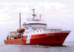
| Platform |
|
||||||||
| Itinerary |
|
||||||||
| Bounds |
|
| Organization |
384 Woods Hole Road
Quissett Campus
Woods Hole, MA02543-1598
(508) 548-8700
|
||||||
|---|---|---|---|---|---|---|---|
| Principal investigators | John Pohlman | ||||||
| Crew members |
|
||||||
| Information specialist(s) |
|
||||||
| Affiliate principal | Michael Riedel, McGill University; Ross Haacke, Geological Survey of Canada | ||||||
| Affiliate staff | Greg Middleton, Geological Survey of Canada (GSC) (seismic/coring); Steve Taylor, GSC (elec./nav./seismic); Peter Neelands, GSC (nav./coring); Tim Claydon, GSC (elec./seismic); Randy Enkin, GSC (coring phys props.); Lionel Esteban, GSC (coring phys. props.); Ross Haacke, GSC (seismic/coring); Graham Standen, GeoForce (Huntec - seismic); John Pohlman, USGS (coring geochem.); Bill Waite, USGS (coring geochem.); Michael Riedel, McGill University (seismic/coring geochem.); Tark Hamilton, Camosun (coring sedimentology); Angela Schlesinger, GSC/Uvic (seismic); Vivan Wang, McGill University (seismic/coring); Meagan Hogg, Camosun (coring); Kelly Rose, Department Of Energy (coring sedimentology); Laura Lapham, Florida State University (coring geochem.) |
| Data category: | Geochemical, Imagery, Location-Elevation, Sampling |
|---|---|
| Data type: | Surveys (geochemical), Photo, Navigation, Chemistry, Geology |
| Equipment | Usage description | Data types | Datasets |
|---|---|---|---|
| GPS (wh) | Navigation | (no data reported) | |
| Ion Chromatograph; | Surveys (geochemical) | (no data reported) | |
| Digital camera | Photo | 1 | |
| Gravity corer | Geology | 1 | |
| Pore water sampling | Chemistry | 1 |
| Dataset name | Equipment | Description | Dataset contact |
|---|---|---|---|
| 2008-029-FA-PH-001 | Digital camera | Cruise photos: collected and held by project partners, not by WHSC. | PARTNER |
| 2008-029-FA-SC-002 | Gravity corer | Cores: 104 cores collected by various project participants. | PARTNER |
| 2008-029-FA-SC-001 | Pore water sampling | Pore water samples: 1827 samples for various analyses; 747 for John Pohlman and 115 for Bill Winters returned to WHSC. | John Pohlman |