Field Activity 2010-018-FA

Identifier 2010-018-FA
Alternate names H-3-10-AR (Menlo Park)
Purpose 
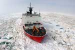
Two-icebreaker US-Canada experiment to identify the outer limits of the extended continental shelf of each nation in the western Arctic Ocean.
Location Western Arctic Ocean;
Summary Collected 12 kHz Bathymetry (Simrad EM122) to identify the 2500-meter contour on widely spaced tracklines. Multichannel seismic profiles were collected aboard the LOUIS S. ST. LAURENT to map sediment thicknesses.
Info derived Bathymetric maps; Sea floor map; Sediment thickness maps;
Comments No WHSC staff were aboard the Canadian ice breaker LOUIS S. ST. LAURENT (J. Childs, USGS-Menlo Park, CA will be liaison aboard LOUIS). Project = Law of the Sea - New Data Acquisition, Law of the Sea - New Data Acquisition
URL
Platform
Healy
Length 420 feet; beam 82 feet; draft 29 feet.
Itinerary
Start Dutch Harbor, AK 2010-08-03
End Barrow, AK 2010-09-05
Days in the field 34
Bounds
West -166.289
East -129.375
North 84.05256
South 71.96539

Personnel

Organization
384 Woods Hole Road
Quissett Campus
Woods Hole, MA02543-1598
(508) 548-8700
Principal investigators Deborah R HutchinsonWilliam W Danforth
Crew members
Thomas F O'Brien
Scientist, Staff
Information specialist(s)
William W Danforth
Specialist, Information
Affiliate principal Brian Edwards, USGS-Menlo Park, CA

Data types and categories

Data category: Location-Elevation, Seismics, Sonar
Data type: Navigation, Sub Bottom Profiler, Multibeam

Equipment used

Equipment Usage description Data types Datasets
GPS (wh) Navigation (no data reported)
Knudsen echo sounder 320B/R Sub Bottom Profiler (no data reported)
Simrad EM120 Multibeam (no data reported)

Publications

Samples collected during this field activity