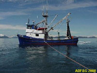
Trace metal sampling in the Copper River region of the Gulf of Alaska.
Location
Copper River region, Gulf of Alaska, Alaska, United States, North America, North Pacific;
Summary
Recent work has suggested that high iron supply may contribute to a northward increase in phytoplankton biomass along the U.S. west coast, consistent with 'bottom-up' control of these coastal ecosystems. We examined this hypothesis in waters of the Copper River plume and nearby continental shelf in the northern Gulf of Alaska. These are the first data we know of examining 'bottom up' control of this coastal ecosystem by the supply of nitrate and iron. These are also the first data we know of examining seasonal variability in the mechanisms that supply iron to this region, and in the iron concentrations. Cruises were carried out in early April (late winter conditions), early May (peak bloom conditions) and late July (peak river discharge). Sampling consisted in each case of bottle and CTD casts at five stations, and continuous surface-water sampling. High concentrations (several hundred nM) of 'total dissolveable' Fe (unfiltered, pH ~2) were present in surface-waters spanning the continental shelf in early April 2010, from resuspension of fine glacial flour. Concentrations decreased dramatically beyond the shelf break. This fine particulate matter represents a large source of 'dissolved' Fe to these waters. Surface-water nitrate concentrations were fairly uniform (~15 uM) across the entire shelf at this time, due to deep winter mixing. By late July this shelf particulate Fe source is greatly diminished, owing to strong stratification. Yet there is abundant 'total dissolveable' Fe (several uM) at this time from the Copper River plume (largest single freshwater source to the GoA) and lower, significant concentrations in the AK coastal current (that reflect the cumulative impact of melting glaciers from further south). By late July this abundant supply of iron in the Copper River vicinity, together with strong stratification, lead to complete consumption of surface-water nitrate across the entire shelf (and extending tens of km beyond the shelf). These data are consistent with the idea that high primary productivity in this region is fueled by abundant wintertime surface-water nitrate, together with iron supply from fine, labile, glacier-derived particulate matter from seasonally variable sources.