Field Activity 2011-018-FA

Identifier 2011-018-FA
Purpose Inspect perimeter of Long Pond and evaluate potential hazards to IRIS navigation for upcoming geophysical survey.
Location Long Pond, Falmouth, Massachusetts
Summary Completed visual inspection of perimeter of pond and observed potential hazards to IRIS navigation. All potential hazards visible on extant aerial imagery, so no data recorded.
Comments 
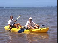
kayak survey with GPS to record location of potential hazards as necessary. Project = Common Services Support,
Platform
Kayak
Kayak-type Platform
Itinerary
Start Long Pond pumping station 2011-03-17
End Long Pond pumping station 2011-03-17
Days in the field 1
Bounds
West -70.6262
East -70.60844
North 41.58541
South 41.57038

Personnel

Organization
384 Woods Hole Road
Quissett Campus
Woods Hole, MA02543-1598
(508) 548-8700
Principal investigators E. Robert Thieler
Crew members
Andrew Schroth
Scientist, Staff
Information specialist(s)
Wayne E Baldwin
Specialist, Information

Data types and categories

Data category: Location-Elevation
Data type: Navigation

Equipment used

Equipment Usage description Data types Datasets
GPS (wh) Navigation (no data reported)

Publications

Samples collected during this field activity