| Identifier |
2012-005-FA |
| Purpose |
Chirp and side-scan cruise |
| Location |
Mid-Atlantic Bight, United States, North America, North Atlantic |
| Summary |
almost 1000 km of chirp and side scan data collected around the Baltimore, Washington, and Norfolk canyons |
| Comments |
Project = NRC/Tsunami Landslide, |
| Projects |
|
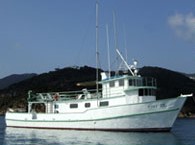
| Platform |
| Tiki XIV 80 feet
|
 |
|
| Itinerary |
| Start |
Ocean City MD |
2012-05-20 |
| End |
Ocean City, MD |
2012-05-28 |
| Days in the field |
7 |
|
| Bounds |
| West |
-73.8281 |
| East |
-70.13672 |
| North |
38.27269 |
| South |
35.24562 |
|