| Identifier | 2015-619-FA | ||||||||
|---|---|---|---|---|---|---|---|---|---|
| Also known as | CCE Deployment 2015 | ||||||||
| Purpose | Coordinated Canyon Experiment - initial deployment of moorings (MS1, 2, & 3) and MBARI instrumentation in the upper canyon | ||||||||
| Location | Monterey Canyon, Monterey Bay, California, United States, Pacific Ocean | ||||||||
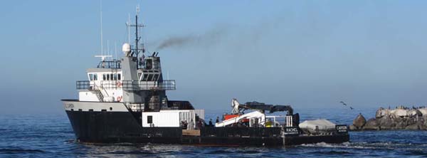
| Summary | Data submitted for FAD; recovered on 2016-610-FA Mooring numbers: CCE15M1A CCE15M2A CCE15M3A USGS personnel at sea included Kurt Rosenberger, Joanne Ferreira, Cordell Johnson, Peter Dal Ferro, Jenny White, Katherine Coble. MS2 and MS3 deployed 10/5; MS1 deployed 10/6. Successful deployment completed ahead of schedule. | ||||||||
| Info derived | Deployment of three moorings in upper Monterey Canyon as part of the CCE | ||||||||
| Comments | This was a joint field operation with MBARI as part of the CCE. WinFrog nav. moorings were recovered on 2016-610-FA | ||||||||
| Projects | |||||||||
| Platform |
|
||||||||
| Vehicles | None |
||||||||
| Itinerary |
|
||||||||
| Bounds |
|
||||||||
| Marine operations | Yes |
| Organization | Other(Other) |
||||||
|---|---|---|---|---|---|---|---|
| Principal investigators | Joanne C. ThedeKurt RosenbergerKatherine L Coble | ||||||
| Crew members |
|
||||||
| Information specialist(s) |
|
||||||
| Affiliate principal | Charles K. Paull (MBARI) |
| Data category: | Location-Elevation, Sampling, Time Series |
|---|---|
| Data type: | Navigation, Geology, Mooring (physical oceanography) |
| Equipment | Usage description | Data types | Datasets |
|---|---|---|---|
| navigation | Navigation | (no data reported) | |
| Sediment trap | Sediment Properties, Geology | (no data reported) | |
| Moorings - Tripods | Mooring (physical oceanography) | 1 |
| Dataset name | Equipment | Description | Dataset contact |
|---|---|---|---|
| Time-series oceanographic data from the Monterey Canyon, CA October 2015 - March 2017 | Moorings - Tripods | Time-series data of water depth, velocity, turbidity, and temperature were acquired between 5 October 2015 and 21 March 2017 within the Monterey Canyon off of Monterey, CA, USA. In order to better understand the triggering, progression and evolution of turbidity currents in Monterey Submarine Canyon, an experiment was designed to directly measure velocity, suspended sediment and physical water properties (temperature, salinity and density) along the canyon axis during an 18-month period. Three moorings in the upper canyon (MS1, MS2, MS3) containing oceanographic instruments and Anderson- type sediment traps were deployed during three consecutive six-month periods (A: October 2015 - April 2016, B: April - October 2016, C: October 2016 - March 2017). In addition, a bottom platform to the South of the canyon head (MS0) housed instrumentation to measure currents and waves on the adjacent shelf. The mooring diagram image files are a generalized representation of the deployed instrumentation at each site, and are included as a visual aid for understanding the sampling environment. A text file of the specific sensors listing parameters measured is also included. | Joanne C. Thede |