| Identifier | 2016-030-FA | ||||||||
|---|---|---|---|---|---|---|---|---|---|
| Purpose | Jetyak operations to map Sandwich Town Beach nearshore | ||||||||
| Location | Sandwich Town Neck Beach, Cape Cod Bay, Massachusetts, United States, Atlantic Ocean | ||||||||
| Summary | Jetyak bathymetric/backscatter survey of the nearshore was completed | ||||||||
| Info derived | bathymetry, backscatter, navigation | ||||||||
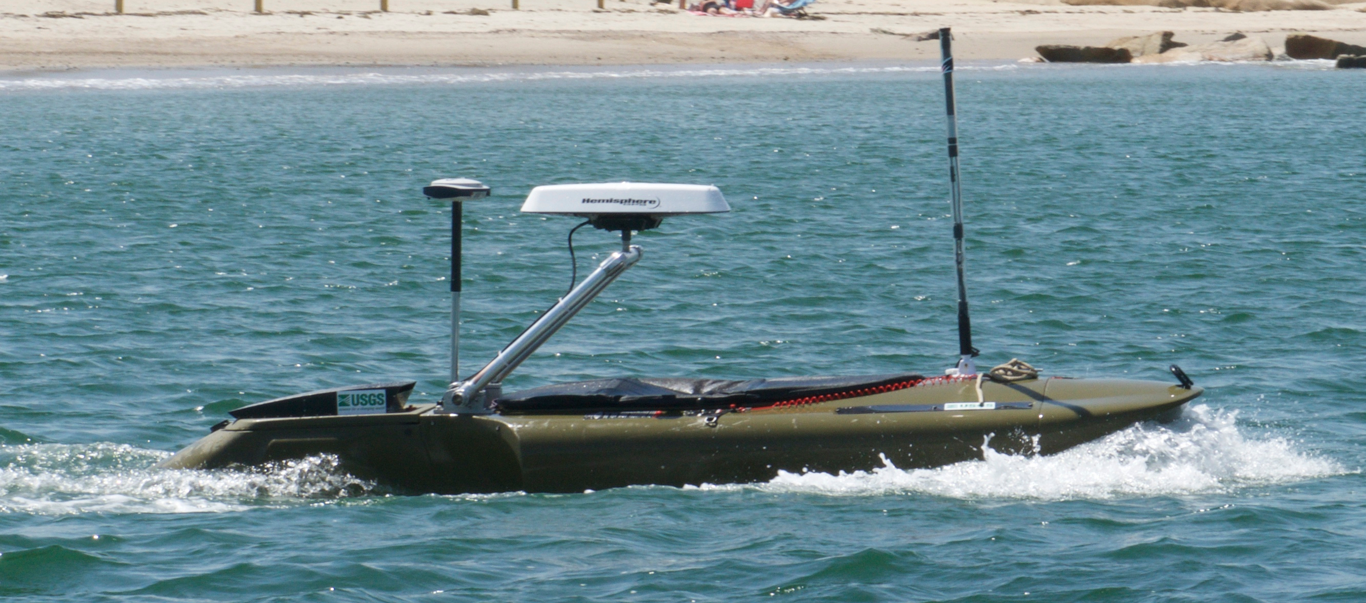
| Comments | The RTK-GPS system we are using is a Spectra SP80. We are also using a Hemisphere GPS heading system installed on the jetyak. Entries for this field activity are based on entries from Field Activity 2016-006-FA. Platform used for sidescan/bathymetry/navigation is the USGS modified kayak named the jetyak. | ||||||||
| Projects | |||||||||
| Platform |
|
||||||||
| Itinerary |
|
||||||||
| Bounds |
|
| Organization |
384 Woods Hole Road
Quissett Campus
Woods Hole, MA02543-1598
(508) 548-8700
|
||||||||||||
|---|---|---|---|---|---|---|---|---|---|---|---|---|---|
| Principal investigators | Christopher R Sherwood | ||||||||||||
| Crew members |
|
||||||||||||
| Information specialist(s) |
|
| Data category: | Location-Elevation, Sonar |
|---|---|
| Data type: | Navigation, Sidescan, Single Beam |
| Equipment | Usage description | Data types | Datasets |
|---|---|---|---|
| Humminbird 898c HD SI Combo (Jetyak) | A Humminbird 898c HD SI Combo GPS/Fish Finder remote sensing instrument was used to collect sidescan, single beam bathymetry, and DGPS navigation. The equipment is mounted in the hull of the jetyak | Sidescan, Single Beam, Navigation | 3 |
| Spectra Precision SP80 | Two receivers were used to collect satellite range and position data, one located on Sandwich Beach (base), and one located on the jetyak (rover). | Navigation | 1 |
| Dataset name | Equipment | Description | Dataset contact |
|---|---|---|---|
| 2016-030-FA_backscatter | Humminbird 898c HD SI Combo (Jetyak) | 1-meter resolution image mosaic representing sidescan sonar data collected by the U.S. Geological Survey during field activity 2016-030-FA offshore Sandwich Beach, MA in June 2016 (24-bit GeoTIFF, UTM Zone 19N, NAD83-HARN) | William W Danforth |
| 2016-030-FA_bathymetry | Humminbird 898c HD SI Combo (Jetyak) | 4-meter resolution bathymetric grid representing single beam data collected by the U.S. Geological Survey during field activity 2016-030-FA offshore Sandwich Beach, MA in June 2016 (32-bit GeoTIFF, UTM Zone 19N, NAD83-HARN) | William W Danforth |
| 2016-030-FA_navigation | Humminbird 898c HD SI Combo (Jetyak) | Comma separated value (CSV) text files of navigation and elevation data collected by the U.S. Geological Survey during field activity 2016-030-FA offshore Sandwich Beach, MA in June 2016 | William W Danforth |
| 2016-030-FA_orthometric | Spectra Precision SP80 | Comma separated value (CSV) text file of post-processed kinematic (PPK) data calculated from raw data logged on two Spectra Precision SP80 GNSS receivers during survey 2016-030-FA conducted offshore Sandwich Beach, MA by the U.S. Geological Survey in 2016 | William W Danforth |