| Identifier | 2018-029-FA | ||||||||
|---|---|---|---|---|---|---|---|---|---|
| Purpose | Collect seabed sediment samples for geological mapping project | ||||||||
| Location | Stellwagen Bank NMS | ||||||||
| Info derived | Sediment samples for geological mapping | ||||||||
| Comments | Travel to and from Scituate, MA for day-cruises to Stellwagen Bank. CTD required as for previous cruises. Load Auk in Scituate, MA | ||||||||
| Projects | |||||||||
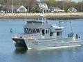
| Platform |
|
||||||||
| Itinerary |
|
||||||||
| Bounds |
|
| Organization |
384 Woods Hole Road
Quissett Campus
Woods Hole, MA02543-1598
(508) 548-8700
|
||
|---|---|---|---|
| Principal investigators | Page C Valentine | ||
| Crew members |
|
||
| Information specialist(s) |
|
||
| Affiliate principal | Dr. David Wylie, SBNMS |
| Data category: | Location-Elevation, Imagery, Environmental Data, Sampling |
|---|---|
| Data type: | Navigation, Photo, Video, CTD, Geology |
| Name | Description |
|---|---|
| Cruise log | Acquisition and observation log for seabed video and sediment samples collected aboard the R/V Auk on Stellwagen Bank. |
| Equipment | Usage description | Data types | Datasets |
|---|---|---|---|
| Furuno satellite compass SC-30 | The location information for stations was acquired from a satellite navigation receiver (Furuno satellite compass SC-30, GPS receiver). | Navigation | 1 |
| Nikon 7100 digital camera | A Nikon 7100 camera was used to take photos of the sediment sample in the grab sampler to document the texture of the seabed surface, the degree of disturbance during sampling, biological features such as worm tubes, and to estimate the volume of sediment collected. | Photo | 1 |
| GoPro camera | Seabed video images were collected using a GoPro digital video camera mounted on SEABOSS to provide ground-truth information for geophysical datasets and are used in seabed interpretations. Frame-grab images were extracted from the video. | Photo, Video | 2 |
| SBE 19plus V2 SeaCAT Profiler CTD | In addition to the CTD water column profiling, the CTD is equipped with auxiliary sensors to measure fluorescence and turbidity. The instruments were mounted on the SEABOSS frame. | CTD, Fluorescence, Turbidity | 1 |
| SeaBOSS | The SEABed Observation and Sampling System (SEABOSS) was used to collect sediment samples with a modified Van Veen sampler and video images of the seabed with GoPro cameras mounted on the frame. A CTD was mounted horizontally on the SEABOSS frame. | Surveys (biological), Experiments (biological), Species ID, Photo, Video, Geology, Biology | 2 |
| SeaViewer 6000 HD Sea-Drop video camera | Used to guide obstacle avoidance. Mounted on the SEABOSS. | Video | (no data reported) |
| Dataset name | Equipment | Description | Dataset contact |
|---|---|---|---|
| navigation_2016-2019 | Furuno satellite compass SC-30 | Navigation data collected by the U.S. Geological Survey on Stellwagen Bank during six surveys aboard the R/V Auk, May 2016 to April 2019 | Page C Valentine |
| SampleImages_2016-2019 | Nikon 7100 digital camera | Still images in JPEG format of the sediment surface in the grab sampler, collected by the U.S. Geological Survey on Stellwagen Bank during six surveys aboard the R/V Auk, May 2016 to April 2019 | Page C Valentine |
| SeabedImages_2016-2019 | GoPro camera | Seabed still images in JPEG format with EXIF location information collected by the U.S. Geological Survey on Stellwagen Bank during six surveys aboard the R/V Auk, May 2016 to April 2019 | Page C Valentine |
| video_driftlines_2016-2019 | GoPro camera | Video transects of the sea floor collected by the U.S. Geological Survey on Stellwagen Bank during six surveys aboard the R/V Auk, May 2016 to April 2019 | Page C Valentine |
| CTD_2016-2019 | SBE 19plus V2 SeaCAT Profiler CTD | CTD (conductivity-temperature-depth) data collected by the U.S. Geological Survey on Stellwagen Bank during six surveys aboard the R/V Auk, May 2016 to April 2019. Includes density, fluorescence (chlorophyll A), and turbidity configuration of the water column. | Page C Valentine |
| 2016-2019_station_data_summary | SeaBOSS | Station and data summary for data collected by the U.S. Geological Survey on Stellwagen Bank during six surveys aboard the R/V Auk, May 2016 to April 2019 | Page C Valentine |
| q2_stations_geology | SeaBOSS | Station locations in quadrangle 2 in Stellwagen Bank National Marine Sanctuary offshore of Boston, Massachusetts where video, photographs and sediment samples were collected by the U.S. Geological Survey from 1993-2019 - includes sediment sample analyses and interpreted geologic substrate. This shapefile contains the quadrangle 2 station locations, interpreted geologic substrate at each location, and description of sampling type (sediment sample, video, photograph). Station locations that have sediment samples include the sediment analyses data. These stations represent information used in the geologic interpretation. | Page C Valentine |
| Dataset name | Description | Dataset contact |
|---|---|---|
| q2_geologic_interp | Interpretation of the seabed geologic substrates in quadrangle 2 of the Stellwagen Bank National Marine Sanctuary region offshore of Boston, Massachusetts based on data collected by the U.S. Geological Survey from 1993-2019. This interpretation is based on multibeam sonar bathymetry, multibeam backscatter imagery, video, photos, and grain-size analyses of samples collected from the seabed in the time period 1993-2019. | Page C Valentine |