| Identifier | 2021-029-FA | ||||||||
|---|---|---|---|---|---|---|---|---|---|
| Alternate names | DUNEX Topobathy Surveys | ||||||||
| Purpose | We propose to collect detailed topobathy measurements spanning the nearshore and beach/dune throughout the storm and recovery period(s) during hurricane season. Observations from this site will provide insight into cross-shore storm processes and impacts, including wave transformation and shoreline water levels, rapid changes in coastal elevations, on/offshore sediment exchanges, and resulting habitat changes. These detailed measurements will provide a more complete understanding of storm impacts and recovery on natural beach/dune systems, which will allow us to validate and improve forecasts of water levels, coastal change, and habitat. | ||||||||
| Location | Pea Island National Wildlife Refuge, Hatteras Island, North Carolina, United States, Atlantic Ocean | ||||||||
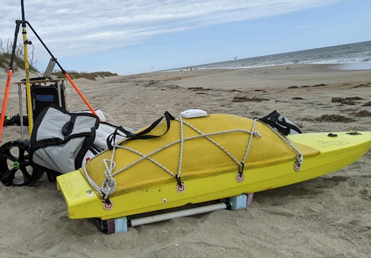
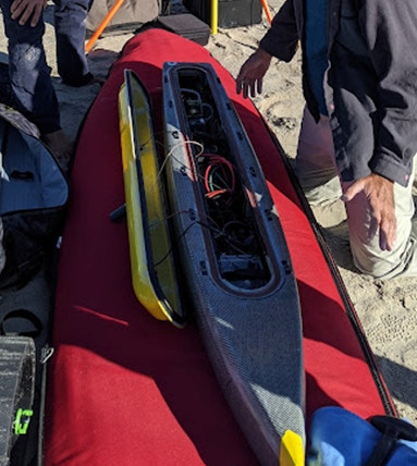
| Summary | DUNEX Pea Island topobathy field work was completed on 10/25/2021. Bathymetry was collected on five different days with the SSV and Yellowfin of WHOI. The heli-kite and Ricoh GRII with plastic ground control points were used to survey eight times. Foot surveys with the SP80 were done on thirteen days. Aeropoints were deployed twice. Two Ricoh GRIIs were broken during field work. Two reference marks were established in the Parking lot of the boat launch on Pea Island. | ||||||||
| Info derived | Topography, bathymetry, imagery | ||||||||
| Comments | This FA is part of DUNEX and covers the topography and bathymetry data while 2021-028-FA covers the cross shore array, grain size, and wave data. Topobathy is related to similar data that was collected in the same spot by Peter Traykovski of WHOI in the donated data 2020-024-DD | ||||||||
| Projects | |||||||||
| Related activities |
2021-028-FA: Project
2020-024-DD: Project
2022-018-FA: Project
|
||||||||
| Platform |
|
||||||||
| Itinerary |
|
||||||||
| Bounds |
|
| Organization |
384 Woods Hole Road
Quissett Campus
Woods Hole, MA02543-1598
(508) 548-8700
|
||||||||
|---|---|---|---|---|---|---|---|---|---|
| Principal investigators | Christopher R Sherwood | ||||||||
| Crew members |
|
||||||||
| Information specialist(s) |
|
||||||||
| Affiliate principal | Jennifer Brown (SPCMSC) Peter Traykovski (WHOI) Patrick Dickhudt (USACE) Katherine Anarde (NCSU) Ryan Mieras (UNCW) Laura Moore (UNC) |
| Data category: | Sonar, Location-Elevation, Imagery |
|---|---|
| Data type: | Sidescan, Single Beam, Navigation, Photo |
| Equipment | Usage description | Data types | Datasets |
|---|---|---|---|
| Digital camera | On this day the first camera (Ricoh GRII) broke and a back-up SONY ILCE-6000 was used to finish the survey. | Photo | (no data reported) |
| Cerulean Sonar S-500 Sounder | Attached to the WHOI Yellowfin. | Single Beam | 1 |
| PingDSP 3DSS-DX-450 | Attached to Needlenose | Sidescan | 1 |
| Spectra Precision SP80 | Spectra Precision equipment used as a rover and base station to collect Real-Time Kinematic (RTK) data (i.e. elevation, position) of a surface or ground control point | Navigation | 3 |
| PPK GPS | An Emlid Reach M2 was attached/hot shoed to the Richo GR II to take a GPS position every time a picture was taken. A base station was also simultaneously taking information. After the field activity the GPS log and base logs were processed. Emlid was also attached to SSV. | Navigation | (no data reported) |
| Echosounder ECS 24D | Attached to SSV-Small Surf Vessel, Echologger ECS D24 used to collect bathymetry data | Single Beam | 1 |
| UAS- heli-kite | Used as the platform to attach the Ricoh GRII cameras | Photo, Navigation, Video | (no data reported) |
| Aeropoint targets | The AeroPoints are deployed as ground control points and have an internal GPS that are uploaded and post-processed in the Propeller network. | Navigation, Transects, Profiles | (no data reported) |
| Ricoh GR II | Photo | 3 |
| Dataset name | Equipment | Description | Dataset contact |
|---|---|---|---|
| Single-beam Bathymetry Data from Yellowfin | Cerulean Sonar S-500 Sounder | Trackline, GPS, and soundings from echosounder attached to the ASV Yellowfin (WHOI). Interpolated product is also available as a topobathy raster. | Jin-Si R Over |
| DUNEX_PINWR_Sidescan | PingDSP 3DSS-DX-450 | Sidescan sonar bathymetry products at the Pea Island National Wildlife Refuge DUNEX Site, North Carolina in October 2021 | Jin-Si R Over |
| DUNEX_PINWR_GCP | Spectra Precision SP80 | Ground control points collected for Helikite operations at the Pea Island National Wildlife Refuge DUNEX Site, North Carolina in September and October 2021 | Jin-Si R Over |
| DUNEX_PINWR_GPS_metdata_v1_1 | Spectra Precision SP80 | Reference marks, walking GPS surveys, CoastCam GCPs, and instrument location data in Pea Island National Wildlife Refuge, North Carolina in November 2020, April, September, and October 2021 (ver. 1.1, May 2024) | Jin-Si R Over |
| Single Beam Bathymetry data from SSV | Echosounder ECS 24D | Bathymetry trackline data, interpolated product is also available and merged with topography. The ECS 24D is attached to the SSV. | Jin-Si R Over |
| DUNEX_PINWR_DSM_2021-029-FA | Ricoh GR II | Digital surface models of Pea Island National Wildlife Refuge DUNEX Site, North Carolina in September and October 2021 | Jin-Si R Over |
| DUNEX_PINWR_ortho_2021-029-FA | Ricoh GR II | Orthomosaics and image locations of Pea Island National Wildlife Refuge DUNEX Site, North Carolina in September and October 2021 | Jin-Si R Over |
| Heli-kite topography surveys | Ricoh GR II | Ricoh camera is attached to Helikite and takes a picture every second. Photos are then used in structure-from-motion | Jin-Si R Over |
| Dataset name | Equipment | Description | Dataset contact |
|---|---|---|---|
| DUNEX_PINWR_GPS | Spectra Precision SP80 | Reference marks, walking GPS surveys, CoastCam GCPs, and instrument location data in Pea Island National Wildlife Refuge, North Carolina in November 2020, April, September, and October 2021 | Jin-Si R Over |
| Dataset name | Description | Dataset contact |
|---|---|---|
| DUNEX_PINWR_Topobathy | Topobathy products in Pea Island National Wildlife Refuge, North Carolina in November 2020 and April, September, and October 2021 | Jin-Si R Over |