We propose to deploy a bottom landing frame in the nearshore off of Pea Island NWR to collect detailed waves and current data in conjunction with hydrodynamic measurements in a cross-shore array spanning the nearshore and beach/dune, topo-bathy survey data, throughout the storm and recovery period(s) during hurricane season. Observations from this site will provide insight into cross-shore storm processes and impacts, including wave transformation and shoreline water levels, rapid changes in coastal elevations, on/offshore sediment exchanges, and resulting habitat changes. These detailed measurements will provide a more complete understanding of storm impacts and recovery on natural beach/dune systems, which will allow us to validate and improve forecasts of water levels, coastal change, and habitat.
Location
Pea Island National Wildlife Refuge, Hatteras Island, North Carolina, United States, Atlantic Ocean
Summary
Deployed 9/2/2021. Six sediment samples collected. Nanopod on bottom @ 11:34 UTC. CTD cast.
Recovered 11/2/2021. CTD cast. Size sediment samples collected. Couldn't communicate with release. Sent in divers. Nanopod on deck @ 17:40 UTC.
Info derived
Waves, currents, pressure, water level, meteorology, sediment grain size.
Comments
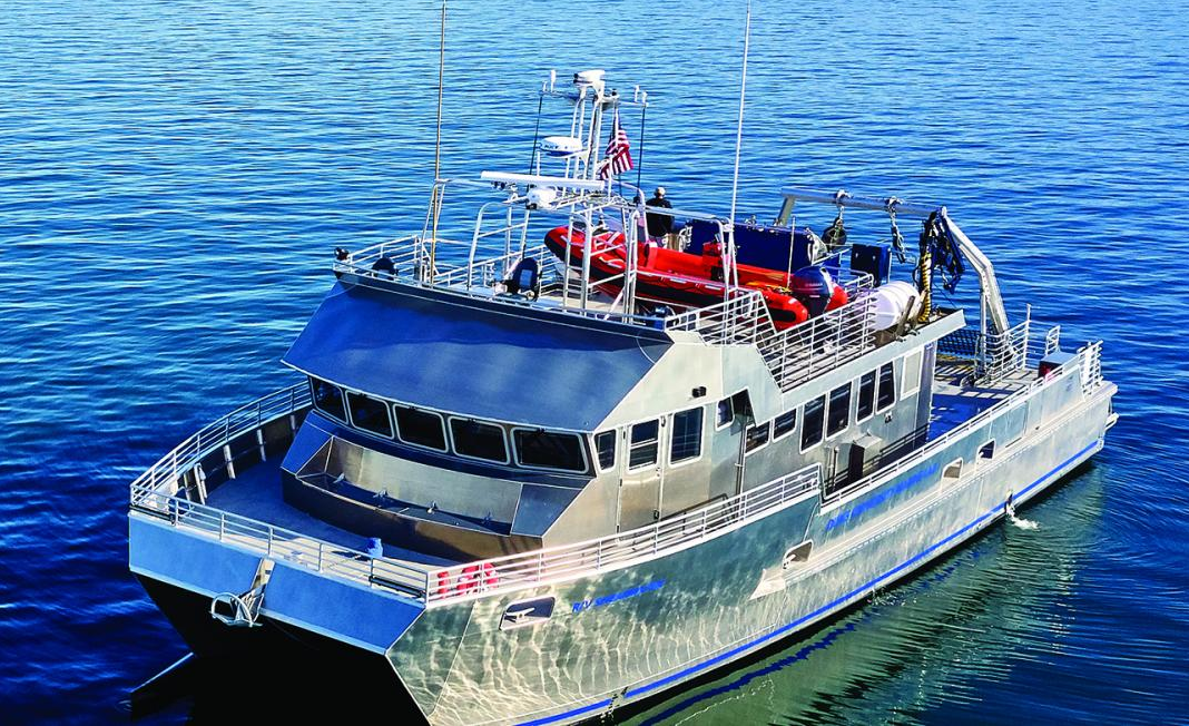
R/V Shearwater for this work is out of the Duke Marine Lab in Beaufort, NC, not a NOAA vessel.
Grab sampler used is a new Shipek owned by WHCMSC.
Entries for this field activity are based on entries from Field Activity 2021-028-FA.
77-foot catamaran; cruising speed of 24 knots; 16-foot auxiliary boat.
Itinerary
Start
Beaufort, NC
2021-09-01
End
Beaufort, NC
2021-11-02
Days in the field
4
Activity events
Start date
End date
Description
Account
2021-09-01
2021-09-02
Departed Beaufort, NC on the R/V Shearwater 9/1/2021 and traveled overnight to Pea Island. Deployed nanopod bottom lander and collected grain size samples on 9/2/2021. (Olson & Bales)
GX.21.LQ00.GJAEF.00
2021-11-01
2021-11-02
Departed Beaufort, NC on R/V Shearwater on 11/1/2021 and traveled to Pea Island overnight. Recovered nanopod off of Pea Island, NC using R/V Shearwater and Vicarious Charters vessel for diving support with USGS divers on 11/2/2021.
Personnel- A. Olson & R. Bales (R/V Shearwater); E. Marsjanik, N. Randall, & S. Brosnahan (Vicarious Charters)
Grain-size analysis data of sediment samples from the beach and nearshore environments at the Pea Island National Wildlife Refuge DUNEX site, North Carolina in 2021. (version 2, supersedes version 1)