| Identifier | 2022-005-FA | ||||||||
|---|---|---|---|---|---|---|---|---|---|
| Alternate names | Ocean Infinity Proj Num: 104313 | ||||||||
| Purpose | High resolution mapping and photographic imaging of past nodule extraction activities | ||||||||
| Location | Blake Plateau | ||||||||
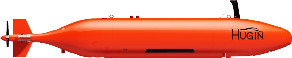
| Summary | Data were collected using a Hugin 6000 AUV launched from the M/V Deep Helder during 7 dives between Aug 5th and 11th. Data were collected along 758 linear kilometers of survey lines covering approximately 29 square kilometers. | ||||||||
| Info derived | Seafloor morphology, sub-bottom structure, benthic environmental characterization | ||||||||
| Comments | This survey was originally planned for the NOAA Ship Nancy Foster, but is now using the M/V Deep Helder owned and operated by MMT/Ocean Infinity https://www.mmt.se/fleet/deep-helder/ | ||||||||
| Projects | |||||||||
| Platform |
|
||||||||
| Itinerary |
|
||||||||
| Bounds |
|
| Organization |
USGS, Wetland and Aquatic Research Center
Gainesville, FL
|
||
|---|---|---|---|
| Organization | National Oceanic and Atmospheric Administration(NOAA) |
||
| Organization |
384 Woods Hole Road
Quissett Campus
Woods Hole, MA02543-1598
(508) 548-8700
|
||
| Principal investigators | Jason Chaytor | ||
| Crew members |
|
||
| Information specialist(s) |
|
||
| Affiliate principal | Amanda Demopoulos, WARC |
| Data category: | Sonar, Seismics, Imagery, Environmental Data |
|---|---|
| Data type: | Sidescan, Multibeam, Sub Bottom Profiler, Photo, CTD |
| Equipment | Usage description | Data types | Datasets |
|---|---|---|---|
| Other | Unknown, Multibeam, Single Beam, Sidescan, Interferometric, Sound Velocity | (no data reported) | |
| Other | Unknown, Multichannel, Boomer, Sub Bottom Profiler, Sparker, Bubble Gun, Air Gun / Water Gun, Ocean Bottom Seismometer, Sonobuoy | (no data reported) | |
| Digital camera | Photo | (no data reported) | |
| Other | Unknown, Meteorology, CTD, Temperature, pH, CO2, Radon, Conductivity, Current, Dissolved Oxygen, Turbidity, Fluorescence, Wave, ORP, Tide, Methane, Depth, Light, Nitrate, Gas Hydrates, Density, Sediment Properties, Osmometic Pressure, Chlorophyll, Nutrients, Pressure | (no data reported) |