Field Activity 2022-629-FA

Identifier 2022-629-FA
Purpose Evaluate deep sea and mesophotic coral habitats impacted and reference sites in the northern Gulf of Mexico in response to the 2010 DWH Oil Spill.
Location Gulf of Mexico
Summary 11 CTD casts were conducted, collecting sensor water column profiles and discrete sampling for seaweed nutrient analysis. Operations were reduced due to shortened cruise schedule related to COVID-19 cases onboard.
Info derived CTD operations (instrumental and discrete water sampling) at known impacted and reference sites in the northern Gulf of Mexico i
Comments 
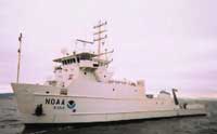
Vessel: NOAA Ship Nancy Foster Cruise Dates: Leg 1: August 8 - August 18, 2022. Embarking and disembarking from Pascagoula, MS. Leg 2: August 21 - August 30, 2022. Embarking and disembarking from Pascagoula, MS.
Projects
Platform
Nancy Foster
Length 187 feet; beam 40 feet; draft 12.8 feet.
Vehicles
None
Itinerary
Start Pascagoula, MS 2022-08-08
End Pascagoula, MS 2022-08-30
Days in the field 21
Bounds
West -97.91032478
East -81.73598918
North 31.95216224
South 24.20688962

Personnel

Organization
2885 Mission Street
Santa Cruz, CA95060
(831) 460-7401
Principal investigators Nancy G Prouty
Crew members
Information specialist(s)
Joanne C. T Ferreira
Specialist, Information
Affiliate principal Randy Clark (NOAA) Amanda Demopoulos (USGS)

Data types and categories

Data category: Sampling, Environmental Data
Data type: Chemistry, Nutrients, CTD

Equipment used

Equipment Usage description Data types Datasets
Nutrient sampler Chlorophyll, Nutrients (no data reported)
Hand-grab sample Biology, Chemistry, Geology (no data reported)
CTD_SeaBird CTD (no data reported)

Publications

Samples collected during this field activity