Field Activity 2022-630-FA

Identifier 2022-630-FA
Purpose Evaluate deep sea and mesophotic coral communities impacted and reference sites in the northern Gulf of Mexico in response to the 2010 DWH Oil Spill.
Location Gulf of Mexico
Summary 35 CTD casts we conducted at water depths <200 m. Water samples were collected at discrete sample depths within the water column, preserved and are pending for nutrient analysis. Raw CTD is going to be processed in preparation for data release.
Info derived CTD (instrumental data and discrete water column nutrient data) operations at known impacted and reference sites in the northern Gulf of Mexico in response to the 2010 DWH Oil Spill.
Comments 
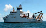
Vessel: NOAA Ship Pisces Cruise Dates: Leg 1: June 29 - July 14, 2022. Pascagoula, MS Leg 2: July 17 - July 30, 2022. Pascagoula, MS
Projects
Platform
Pisces
Vehicles
None
Itinerary
Start Pascagoula, MS 2022-06-29
End Pascagoula, MS 2022-07-30
Days in the field 30
Bounds
West -95.62479776
East -80.85728517
North 30.44867368
South 25.48295118
Marine operations Yes

Personnel

Organization
2885 Mission Street
Santa Cruz, CA95060
(831) 460-7401
Principal investigators Nancy G Prouty
Crew members
Nadine Golden
Scientist, Staff
Information specialist(s)
Joanne C. T Ferreira
Specialist, Information
Affiliate principal Stacey Harter (NOAA)

Data types and categories

Data category: Sampling, Environmental Data
Data type: Chemistry, CTD

Equipment used

Equipment Usage description Data types Datasets
Other Unknown, Geology, Biology, Chemistry (no data reported)
CTD_SeaBird CTD (no data reported)

Publications

Samples collected during this field activity