| Identifier |
2026-630-FA |
| Alternate names |
Reefense O'ahu deployment 10/2026 |
| Purpose |
Deploy oceanographic instrumentation and conduct underwater SfM mapping of DARPA Reefense structures |
| Location |
offshore Barber's Point, O'ahu, HI |
| Info derived |
tidal height, wave height, wave period, wave direction, current speed, current direction, water temperature, wind speed, wind direction, air temperature, rainfall, bathymetry |
| Projects |
|
| Platform |
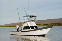
| Alyce C 28-ft-long
|
 |
|
| Itinerary |
| Start |
Barber's Point, O'ahu, HI |
2026-10-19 |
| End |
Barber's Point, O'ahu, HI |
2026-10-30 |
| Days in the field |
10 |
|
| Bounds |
| West |
-158.15456629 |
| East |
-158.05282474 |
| North |
21.34694398 |
| South |
21.26608024 |
|
| Marine operations |
Yes |
| Scuba operations |
Yes |
