| Identifier | B108SC | ||||||||
|---|---|---|---|---|---|---|---|---|---|
| Alternate names | B-1-08-SC | ||||||||
| Also known as | B0108SC | ||||||||
| Purpose | This cruise aboard the Ocean Survey Vessel (OSV) Bold, a cooperative effort between the U.S. Environmental Protection Agency (EPA) and the U.S. Geological Survey (USGS), is comprised of six integrated components; 1-4 (cancelled/postponed) 5 and 6 during this field activity. 1) seafloor sampling (box corer) at three EPA disposal sites to confirm the quality and cleanliness of disposed materials, 2) seafloor sampling (box corer) at five offshore southern California Borderland deepwater basins in support of a mass balance study of discharged tDDT, 3) seafloor sampling (box corer) on the mainland shelf near the Sanitation Districts of Los Angeles County (LACSD) ocean outfall at Whites Point to investigate porewater sampling protocols, 4) seafloor sampling (box corer) at EPA disposal sites and in deepwater offshore basins to collect biological voucher samples 5) collection of high-resolution seismic-reflection profiles offshore of Huntington Beach, CA to assess neotectonic activity (recency of fault motion and potential for tectonic-related hazards), and (6) seafloor sampling (gravity corer) to age-date recency of fault motion identified in (5) above and to support sediment transport studies. | ||||||||
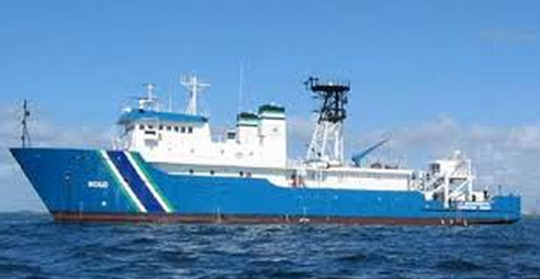
| Description | United States Geological Survey, Menlo Park, California,Environmental Protection Agency Region 9. Chief Scientists: Holly Ryan, USGS, Jamie Conrad, USGS, Doug Pabst, EPA, Allan Ota, EPA. Seismic data (sparker, Chirp, Differential GPS, Yonav) of field activity B-1-08-SC in Southern California Borderland including: San Diego Trough, and San Pedro Basin from 04/28/2008 to 05/05/2008 | ||||||||
| Location | and San Pedro Basin | ||||||||
| Info derived | recency of fault motion, age dating, stratigraphy/sedimentology | ||||||||
| Comments | Edwards/Lee sampling leg cancelled; Ryan/Conrad geophysical leg now B-1-08-SC Staff information imported from InfoBank Amy Wagner (EPA, R9, , Chemist) Doug Pabst (EPA, R2, , Chief Scientist) Allan Ota (EPA, R9, , Co, chief scientist) Don Cadien (LACSD, , Biologist) Brad Carkin (USGS, MP, , MSCL technician) Jamie Conrad (USGS, MP, , Navigator) Pete Dartnell (USGS, MP, , Marine Geologist) Brian Edwards (USGS, MP, , Watch Leader/Co, Lead Scientist) Robert Eganhouse (USGS, Reston, , Chemist) Tim Elfers (USGS, MP, , Marine Technician) John Gann (USGS, MP, , Electronics Technician) Gary Hopkins (, Chemist) - Stanford Homa Lee (USGS, MP, , Watch Leader/Co, Lead Scientist) Terry Lerch (USGS, Reston, , Chemist) Bill Orem (USGS, Reston, , Chemist) Kevin O'Toole (USGS, MP, , Marine Technician, Lead, ) Carol Reiss (USGS, MP, , Navigator/FACS) Mike Torresan (USGS, MP, , Marine Geologist) | ||||||||
| Platform |
|
||||||||
| Itinerary |
|
||||||||
| Bounds |
|
||||||||
| Activity | Seismic |
| Organization | U.S. Environmental Protection Agency(EPA) |
||||||||||||||||||||||||
|---|---|---|---|---|---|---|---|---|---|---|---|---|---|---|---|---|---|---|---|---|---|---|---|---|---|
| Organization |
2885 Mission Street
Santa Cruz, CA95060
(831) 460-7401
|
||||||||||||||||||||||||
| Principal investigators | James E ConradHolly Ryan | ||||||||||||||||||||||||
| Crew members |
|
||||||||||||||||||||||||
| Information specialist(s) |
|
||||||||||||||||||||||||
| Affiliate principal | Doug Pabst (EPA, R2, , Chief Scientist), Allan Ota | ||||||||||||||||||||||||
| Affiliate staff | Amy Wagner (EPA, R9, , Chemist),Allan Ota (EPA, R9, , Co, chief scientist),Gary Hopkins (, Chemist) - Stanford,Terry Lerch (USGS, Reston, , Chemist),Bill Orem (USGS, Reston, , Chemist) |
| Data category: | Location-Elevation, Seismics |
|---|---|
| Data type: | Navigation, Boomer, Sparker |
| Equipment | Usage description | Data types | Datasets |
|---|---|---|---|
| Chirp | Boomer | 3 | |
| Differential GPS | Navigation | 2 | |
| sparker | Sparker | 3 | |
| Yonav | Navigation | (no data reported) |
| Dataset name | Equipment | Description | Dataset contact |
|---|---|---|---|
| Chirp seismic data | Chirp | data on CMGDS | Ray W Sliter |
| highres.chirp | Chirp | Metadata | James E Conrad |
| Seismic FFID/Shot/CDP data | Chirp | Provisional best file | James E Conrad |
| Best file with nav in ArcInfo E00 format | Differential GPS | Arc Files | James E Conrad |
| Global positioning system (GPS) data | Differential GPS | Provisional best file | James E Conrad |
| Minisparker seismic-reflection data collected between Huntington Beach and San Diego, offshore of southern California | sparker | This dataset includes raw and processed, high-resolution seismic-reflection data collected in 2008 to collect information on active offshore faults. The survey area is offshore southern California between Huntington Beach and San Diego. The data were collected aboard the R/V Bold. The seismic-reflection data were acquired using a SIG 2mille minisparker. Subbottom acoustic penetration spanned tens to several hundreds of meters, variable by location. | Ray W Sliter |
| Seismic FFID/Shot/CDP data | sparker | Provisional best file | James E Conrad |
| Sparker seismic data | sparker | data on CMGDS | Ray W Sliter |