| Identifier | C283NC | ||||||||
|---|---|---|---|---|---|---|---|---|---|
| Alternate names | C-2-83-NC | ||||||||
| Description | Chief Scientist: Mike Field. Geological and Geophysical data (sidescansonar, uniboom, 12khz, rangerange, LoranC, transitsatellite, vibratingcore) of field activity C-2-83-NC in Offshore Crescent City, Northern California from 09/27/1983 to 10/01/1983 | ||||||||
| Location | Northern California | ||||||||
| Comments | Staff information imported from InfoBank Barb Blubaugh (USGS) - Navigator Bill Kahle - Chief Engineer Bill Lambie - Ship Captain Carol Hirozawa (USGS Western Region) - Navigator Charlaine Daniel - Navigator Gary Mann (USGS Western Region) - Watchstander Hal Williams (USGS Western Region) - Mechanical Technician Jim Nicholson (USGS Western Region) - Electronics Technician Keith Kvenvolden (USGS Western Region) - Geochemist Kevin O'Toole (USGS Western Region) - Mechanical Technician Kris Johnson (USGS Western Region) - Watchstander Marge Golan (Geochemist) - Bac Mike Field (USGS Western Region) - Chief Scientist Mike Torresan (USGS Western Region) - Geologist Monty Hampton (USGS Western Region) - Geologist Paul Haley - Chief Mate Peter Roy - Geologist Rob Kayen (USGS Western Region) - Watchstander | ||||||||
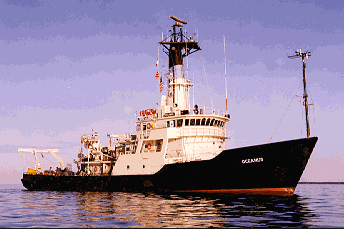
| Platform |
|
||||||||
| Itinerary |
|
||||||||
| Bounds |
|
||||||||
| Activity | Geological and Geophysical |
| Principal investigators | Michael E Field | ||||||||||||||||||||||||
|---|---|---|---|---|---|---|---|---|---|---|---|---|---|---|---|---|---|---|---|---|---|---|---|---|---|
| Crew members |
|
||||||||||||||||||||||||
| Affiliate staff | Bill Kahle - Chief Engineer,Bill Lambie - Ship Captain,Marge Golan (Geochemist) - Bac,Paul Haley - Chief Mate,Peter Roy - Geologist |
| Data category: | Location-Elevation, Sampling, Seismics, Sonar |
|---|---|
| Data type: | Navigation, Geology, Boomer, Sidescan, Single Beam |
| Equipment | Usage description | Data types | Datasets |
|---|---|---|---|
| uniboom | Boomer | 2 | |
| 12khz | Single Beam | 2 | |
| rangerange | Navigation | 1 | |
| LoranC | Navigation | (no data reported) | |
| transitsatellite | Navigation | 1 | |
| vibratingcore | Geology | 3 | |
| navigation | Navigation | 2 | |
| sidescansonar | Sidescan | 1 |
| Dataset name | Equipment | Description | Dataset contact |
|---|---|---|---|
| hires_uniboom survey information | uniboom | Michael E Field | |
| Seismic FFID/Shot/CDP data c-2-83-nc.410_051 | uniboom | Provisional best file | Michael E Field |
| 12kHz bathymetry paper rolls | 12khz | analog holdings | Michael E Field |
| 12khz survey information | 12khz | Michael E Field | |
| delnortenav_rangerange | rangerange | Michael E Field | |
| transitsatellite | transitsatellite | Michael E Field | |
| 35mm microfilm; vibracores | vibratingcore | analog holdings | Michael E Field |
| C-2-83-NC_154032_vibracore_photo | vibratingcore | scanned microfilm | Carol A Reiss |
| vibracores | vibratingcore | analog holdings; working and archive halves | Michael E Field |
| C-2-83-NC_197726_nav_printout | navigation | scanned microfilm | Carol A Reiss |
| start_end_lines | navigation | Michael E Field | |
| http://walrus.wr.usgs.gov/infobank/imag1/c/c283nc/imag/c-2-83-nc.onoff.sidescansonar | sidescansonar | start and end of paper rolls | Michael E Field |