| Identifier | C568SP | ||||||||
|---|---|---|---|---|---|---|---|---|---|
| Alternate names | C-5-68-SP,C1205 | ||||||||
| Description | Lamont-Doherty Earth Observatory. Chief Scientist: A. Lonardi. Geophysical data (bathymetry, gravity, magnetics) of field activity C-5-68-SP in South Pacific from 05/01/1968 to 05/30/1968 | ||||||||
| Location | South Pacific | ||||||||
| Comments | Staff information imported from InfoBank A. Lonardi - Chief Scientist | ||||||||
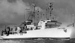
| Platform |
|
||||||||
| Itinerary |
|
||||||||
| Bounds |
|
||||||||
| Activity | Geophysical |
| Organization |
Lamont Doherty Earth Observatory(LDEO)
Pallisades, NY
|
|---|---|
| Organization |
2885 Mission Street
Santa Cruz, CA95060
(831) 460-7401
|
| Affiliate principal | A. Lonardi |
| Data category: | Electro-Magnetic, Location-Elevation, Sonar |
|---|---|
| Data type: | Gravity, Magnetics, Navigation, Single Beam |
| Equipment | Usage description | Data types | Datasets |
|---|---|---|---|
| gravity | Gravity | 1 | |
| magnetics | Magnetics | 1 | |
| navigation | Navigation | 1 | |
| bathymetry | Single Beam | 1 |
| Dataset name | Equipment | Description | Dataset contact |
|---|---|---|---|
| Free Air Anomaly data c-5-68-sp.160_050 | gravity | Provisional best file | Carol A Reiss |
| Edited magnetics data c-5-68-sp.220_050 | magnetics | Provisional best file | Carol A Reiss |
| Integrated navigation (SINS) data c-5-68-sp.050 | navigation | Provisional best file | Carol A Reiss |
| Edited bathymetry data with corrected depths c-5-68-sp.325_050 | bathymetry | Provisional best file | Carol A Reiss |