Bathymetric, bay floor imaging. Conduct sonar surveys in Tomales Bay to establish bay and seafloor morphology. Establish a baseline of bay floor morphology which is essential in determining any future changes on the bay bathymetry in response to the watersheds that flow into the bay.
Description
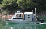
United States Geological Survey, Menlo Park, California. Chief Scientists: John Chin, USGS Menlo Park, Roberto Anima, USGS Menlo Park. Geophysical data (234khz, YoNav) of field activity F-1-04-TB in Tomales Bay, CA from 11/14/2004 to 11/19/2004
Location
CA
Info derived
Swath bathymetry, bay floor backscatter image. Information from this study will be used to produce a habitat map.
Comments
Interferometric swath bathymetry files exist on /imgarc2/F-1-04-TB/ [http://woodshole.er.usgs.gov/operations/sfmapping/swath.htm], brand SEA Model SWATHplus-M, media digital, code SUBX, 234 khz. Yonav GPS nav, media digital, comment WAAS DGPS correction. The Tomales Bay Watershed Council has voiced a need to begin looking at the environmental impacts of human input to the watersheds and feels it important to establish an ecological database that can be used to make comparisons in the future. Surveying would create a framework and this database. Tomales Bay marks the trace of the San Andreas Fault and is the culmination point of tributaries from the Inverness Ridge to the west and the watershed to the east. Geologic and anthropogenic changes are occuring in the Bays and the impact on habitats is unknown. In response to a request from the National Park Service, and the Tomales Bay Watershed Council [http://www.tomalesbaywatershed.org/] to determine the overall morphology of the floor of Tomales Bay, the Coastal and Marine Geology Team proposes to map the bathymetry and produce a detailed geologic and habitat map of Tomales and Bodega Bays. This task is necessary to establish a baseline of the bay floor morphology to compare future geologic and anthropogenic changes that might occur due to changes in land use or development in the surrounding watershed. This task will also be of importance in determining the possible pathways of pollutants entering the bays from the surrounding watersheds.
Staff information imported from InfoBank
John Chin (Co Chief Scientist) - USGS
Roberto Anima (Co Chief Scientist) - USGS
Andy Stevenson (Information Specialist) - USGS
Eleyne Phillips - FACS Coordinator
Mike Boyle (Electronic Technician) - USGS
Larry Kooker (Electronic Technician) - USGS
Gerry O'Brien (Small boat handler) - USGS