Field Activity F109SF

Identifier F109SF
Alternate names F-1-09-SF
Purpose Investigate mechanisms of transport of sediment from shoals to channel, and resuspension response of cohesive sediments to wind waves.
Description United States Geological Survey, Pacific Science Center. Data of field activity F-1-09-SF in South San Francisco Bay from 02/23/2009 to 03/17/2009
Location South San Francisco Bay
Summary Moorings to collect time-series data, and shipboard surveying and sampling during the deployment to further characterize spatial variability in currents, to collect calibration samples for optical measurements of suspended sediment concentration, and to sample bed sediment grain size.
Info derived Current speed and direction, tidal stage, wave properties, suspended sediment concentration, salinity, bed sediment grain size.
Comments 
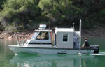
Collaboration with UC Berkeley. Platform used: Retriever (for deployment and retrieval), Frontier (for surveying and sampling).
Projects
Platform
Frontier
Itinerary
Start Oyster Point 2009-02-23
End Oyster Point 2009-03-17
Bounds
West -122.5992
East -121.87542725
North 37.81236071
South 37.43044096

Personnel

Organization
2885 Mission Street
Santa Cruz, CA95060
(831) 460-7401
Crew members
Information specialist(s)
Jessica R Lacy
Specialist, Information

Data types and categories

Data category: Location-Elevation, Sampling, Time Series
Data type: Navigation, Geology, Mooring (physical oceanography)

Equipment used

Equipment Usage description Data types Datasets
instrumentmooring Mooring (physical oceanography) 1
tripod Mooring (physical oceanography) 1
samples Biology, Chemistry, Geology (no data reported)

Datasets

Datasets produced in this activity

Dataset name Equipment Description Dataset contact
Station Information instrumentmooring Joshua Logan
Station Information tripod Joshua Logan

Publications

Samples collected during this field activity