Field Activity H208AR

Identifier H208AR
Alternate names HLY0806, H-02-08-AR, H-2-08-AR
Also known as 2008-009-FA
Purpose Collect bathymetry and gravity data as well as break ice for a second ship as part of delimiting the boundary of the U.S. extended continental shelf in the Eurasian Basin of the Arctic Ocean
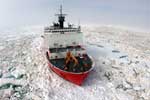
Location Arctic Ocean
Summary There were 5146 km of tracklines (multibeam + subbottom + gravity). Total area imaged was 39,311 km2 with the SeaBeam 2112. 11 stations were occupied for CTD and 10 stations for phytoplankton analysis.
Info derived Multibeam Bathymetry + Gravity (electronic, DVD)
Comments FAN renamed H208AR 10/18/2018 also exists as WH 2008-009-FA FAN created for data on FAD 9/21/2017 Chirp system used;exact model not specified
Projects
Platform
Healy
Length 420 feet; beam 82 feet; draft 29 feet.
Vehicles
None
Itinerary
Start Barrow, AK 2008-09-05
End Barrow, AK 2008-10-01
Bounds
West -142.40078866
East -118.41641366
North 79.70986597
South 67.74998975

Personnel

Organization
2885 Mission Street
Santa Cruz, CA95060
(831) 460-7401
Organization
384 Woods Hole Road
Quissett Campus
Woods Hole, MA02543-1598
(508) 548-8700
Principal investigators Jonathan R Childs
Crew members
Information specialist(s)
Jonathan R Childs
Specialist, Information
Affiliate principal Debbie Hutchinson (USGS, Woods Hole)

Data types and categories

Data category: Electro-Magnetic, Environmental Data, Sampling, Seismics, Sonar
Data type: Gravity, CTD, Biology, Sub Bottom Profiler, Multibeam

Equipment used

Equipment Usage description Data types Datasets
gravity Gravity (no data reported)
CTD Surveys (geochemical), Experiments (geochemical), CTD (no data reported)
planktonnet Biology (no data reported)
512 chirp-source Sub Bottom Profiler (no data reported)
Knudsen Chirp 3200 Sub Bottom Profiler (no data reported)
multibeam Multibeam (no data reported)

Publications

Samples collected during this field activity