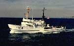
National Marine Fisheries (NOAA) provided the vessel to gather information on the density structure and water clarity of the water column during winter in and over Monterey Canyon. This information will be helpful in the interpretation of data from 6 current moorings that were deployed for a year in the canyon (Aug. 93-Aug. 94).
Description
Chief Scientists: Frank Schwing, Marlene Noble. Geological data (CTDmeter, boxcore) of field activity J-13-94-MB in Monterey Canyon from 11/13/1994 to 11/16/1994
Location
Monterey Canyon
Summary
CTD data was collected at 27 sites in the canyon in depths ranging from 80 to 2800 meters, this data will be processed and stored by MBARI. In addition to the CTD survey, 5 box cores were taken at various sites. One was collected in 1300 m, at a mooring site in Monterey Canyon that registered a probable turbidity current for a week or more last February. The others were in the head of Monterey canyon, head of Soquel canyon and at the junction where Soquel joins Monterey canyon.
Comments
We just got back from a great cruise on the David Star Jordan (even though it was November). National Marine Fisheries provided the vessel so we could gather information on the density structure and water clarity of the water column in winter over and in Monterey Canyon. This information will be helpful in the interpretation of data from the 6 moorings that we deployed for a year there. We also managed to collect 5 box cores. One was collected in 1300 m, at a mooring site in Monterey Canyon that registered a probable turbidity current for a week or more last February. The others were in the head of Monterey canyon, head of Soquel canyon and at the junction where Soquel joins Monterey canyon. These cores are part of our sediment budget program in the Monterey Bay Marine Sanctuary project. USGS participants, myself, Pete Dartnell, Kaye Kinoshita, Roger Lewis, Mary McGann, and Hal Williams.
Staff information imported from InfoBank
Frank Schwing (National Marine Fisheries, NOAA) - Chief Scientist
Marlene Noble (USGS Western Region) - Chief Scientist