| Identifier | K0313BI | ||||||||
|---|---|---|---|---|---|---|---|---|---|
| Alternate names | K-03-13-BI | ||||||||
| Purpose | Map submarine groundwater discharge and nearshore water properties affecting coral community composition, size structure, bleaching and health indicators. | ||||||||
| Description | United States Geological Survey, Pacific Science Center,National Park Service,University of Hawaii,University of California, Berkeley. Chief Scientist: Eric Grossman. Sampling data of field activity K-03-13-BI in west Hawaii Islands, Hawaii from 12/01/2013 to 12/09/2013 | ||||||||
| Location | Hawaii | ||||||||
| Info derived | Nearshore water properties, circulation processes, groundwater flux and plume extent in nearshore | ||||||||
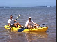
| Comments | kayaks, small skiffs used. Staff information imported from InfoBank Eric Grossman Lisa Marrack Non USGS data manager = Lisa Marrack | ||||||||
| Projects | |||||||||
| Platform |
|
||||||||
| Itinerary |
|
||||||||
| Bounds |
|
||||||||
| Activity | Sampling |
| Organization |
National Park Service(NPS)
multiple locations
|
||
|---|---|---|---|
| Organization |
University of California, Berkeley
Berkely, CA
|
||
| Organization |
University of Hawaii
Honolulu, HI
|
||
| Organization |
2885 Mission Street
Santa Cruz, CA95060
(831) 460-7401
|
||
| Principal investigators | Eric Grossman | ||
| Crew members |
|
||
| Information specialist(s) |
|
||
| Affiliate staff | Lisa Marrack |
| Data category: | Sampling |
|---|---|
| Data type: | Chemistry |
| Equipment | Usage description | Data types | Datasets |
|---|---|---|---|
| samples | Biology, Chemistry, Geology | 1 |
| Dataset name | Equipment | Description | Dataset contact |
|---|---|---|---|
| Water temperature time-series data from nearshore coral reef and anchialine pool locations along the west coast of Hawaii Island (2010-2013) | samples | Time-series data of water temperature were collected at 33 locations along the west coast of the Island of Hawaii, including within Kaloko-Honokohau National Historical Park (KAHO), and Puu o Honaunau National Historical Park (PUHO) between 2010 and 2013 in nearshore coral reef and anchialine pool settings. Temperature sensors were attached to fossil limestone, rock or dead coral within otherwise healthy coral reef settings spanning water depths of 0.1 to 8.84 m (0.3 to 29.0 ft). Continuous measurements were made every 10 or 20 minutes. Due to the large amount of data, the dataset has been split into three files. WaterTempTimeSeries_KAHO-KC.csv includes data from nearshore coral reef locations within Kaloko Bay, which lies within the KAHO boundaries, WaterTempTimeSeries_KAHO.csv includes data from nearshore reef locations and two anchialine pools within the remainder of KAHO, WaterTempTimeSeries_westHawaii.csv includes data from nearshore coral reef locations along west Hawaii coastline, outside of the KAHO boundaries. | Eric Grossman |