| Identifier | K175AR | ||||||||
|---|---|---|---|---|---|---|---|---|---|
| Alternate names | K-1-75-AR | ||||||||
| Description | Chief Scientist: Larry Phillips. Data (bathymetry, magnetics, navigation) of field activity K-1-75-AR in Arctic Ocean from 09/26/1975 to 11/03/1975 | ||||||||
| Location | Arctic Ocean | ||||||||
| Comments | Staff information imported from InfoBank Larry Phillips (USGS Western Region) - Chief Scientist | ||||||||
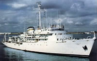
| Platform |
|
||||||||
| Itinerary |
|
||||||||
| Bounds |
|
| Principal investigators | Phillips, Larry |
|---|---|
| Crew members |
| Data category: | Sonar, Electro-Magnetic, Location-Elevation |
|---|---|
| Data type: | Single Beam, Magnetics, Navigation |
| Equipment | Usage description | Data types | Datasets |
|---|---|---|---|
| bathymetry | Single Beam | 2 | |
| magnetics | Magnetics | 3 | |
| navigation | Navigation | 3 |
| Dataset name | Equipment | Description | Dataset contact |
|---|---|---|---|
| Edited bathymetry data with corrected depths k-1-75-ar.320 | bathymetry | Larry Phillips | |
| Edited bathymetry data with corrected depths k-1-75-ar.320_050 | bathymetry | Provisional best file | Larry Phillips |
| Edited magnetics data k-1-75-ar.220 | magnetics | Larry Phillips | |
| Edited magnetics data k-1-75-ar.220_050 | magnetics | Larry Phillips | |
| Edited magnetics data k-1-75-ar.221_050 | magnetics | Provisional best file | Larry Phillips |
| Best file with nav in ArcInfo E00 format | navigation | Larry Phillips | |
| Integrated navigation (SINS) data k-1-75-ar.050 | navigation | Provisional best file | Larry Phillips |
| Integrated navigation (SINS) data k-1-75-ar.050_degree | navigation | Larry Phillips |