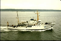
Chief Scientists: N.A. Prahl, G.B. Mills. Geophysical data (gravity, navigation, bathymetry) of field activity M-1-71-NC in Cape Flattery, Washington to Santa Cruz, Northern California from 04/12/1971 to 12/07/1971
Location
Northern California
Summary
313 bottom gravity measurements were made over a 200 square nautical mile area on the Continental Shelf approximately 20 miles due west of Cape Flattery, WA. Observations were made at one nautical mile intervals to establish a test range for evaluating the accuracy and performance of underway sea-surface gravimeters. In addition, 499 bottom gravity measurements were made on the Continental Shelf between the 5 and 100 fathom isobaths from Cape Flattery, WA, to Monterey Bay, ca. Measurements were made at 5 mile intervals as part of the National Ocean Surveys marine gravity program. 32 sea-fix shore stations were established. The shore station pairing for the gravity test range included EPI Mukkaw (north station) and Quill RMS (south station).
Info derived
Gravity range, gravity range contour maps, gravity range bathymetry
Comments
Information from Prahl, N.A., and Mills, G.B. operational data report west coast continental shelf bottom gravity Cape Flattery to Santa Cruz National Oceanic and Atmospheric Administration (NOAA) ship McArthur 1971: Dept. of Commerce, NOAA, NOS, Marine Geophysics Group, 32 p.
Staff information imported from InfoBank
N.A. Prahl - Chief Scientist
G.B. Mills - Chief Scientist