| Identifier | S197SC | ||||||||
|---|---|---|---|---|---|---|---|---|---|
| Alternate names | S-1-97-SC | ||||||||
| Description | Chief Scientist: Kim Klitgord. Geophysical and Sampling data (airgun, 3dot5khz, gravitycore, pipedredge, 24channel) of field activity S-1-97-SC in Santa Monica Basin, California from 05/26/1997 to 06/01/1997 | ||||||||
| Location | California | ||||||||
| Comments | Staff information imported from InfoBank Kim Klitgord (USGS Western Region) - Chief Scientist Kaye Kinoshita (USGS Western Region) - Information Specialist Pat Hart (USGS Western Region) - Geophysicist Ray Sliter (USGS Western Region) - Geophysicist Walter Barnhardt (USGS Western Region) - Geophysicist Brian Edwards (USGS Western Region) - Geologist Homa Lee (USGS Western Region) - Geologist Jane Reid (USGS Western Region) - Watchstander Bill Robinson (USGS Western Region) - Electronics Technician Walt Olson (USGS Western Region) - Mechanical Technician Hal Williams (USGS Western Region) - Mechanical Technician Fred Payne (USGS Western Region) - Electronics Technician | ||||||||
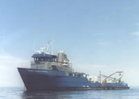
| Platform |
|
||||||||
| Itinerary |
|
||||||||
| Bounds |
|
||||||||
| Activity | Geophysical and Sampling |
| Principal investigators | Klitgord, Kim | ||||||||||||||||||
|---|---|---|---|---|---|---|---|---|---|---|---|---|---|---|---|---|---|---|---|
| Crew members |
|
||||||||||||||||||
| Information specialist(s) |
|
| Data category: | Location-Elevation, Sampling, Seismics |
|---|---|
| Data type: | Navigation, Geology, Air Gun / Water Gun, Multichannel, Sub Bottom Profiler |
| Equipment | Usage description | Data types | Datasets |
|---|---|---|---|
| 3.5khz | Sub Bottom Profiler | (no data reported) | |
| gravitycore | Geology | (no data reported) | |
| pipedredge | Geology | (no data reported) | |
| 24channel | Multichannel | 5 | |
| navigation | Navigation | 2 | |
| airgun | Air Gun / Water Gun | (no data reported) |
| Dataset name | Equipment | Description | Dataset contact |
|---|---|---|---|
| mcs | 24channel | data on FAD | Carol A Reiss |
| migrated | 24channel | data on FAD | Carol A Reiss |
| Multichannel data (stack data) | 24channel | Ray W Sliter | |
| Seismic FFID/Shot/CDP data s-1-97-sc.410_mcs | 24channel | Carolyn Hayashida Degnan | |
| Best file with nav in ArcInfo E00 format | navigation | Carolyn Hayashida Degnan | |
| Global positioning system (GPS) data s-1-97-sc.062 | navigation | Provisional best file | Carolyn Hayashida Degnan |
| Dataset name | Equipment | Description | Dataset contact |
|---|---|---|---|
| Multichannel seismic-reflection data acquired off the coast of southern California - Part A 1997, 1998, 1999, and 2000 | 24channel | Multichannel seismic-reflection (MCS) data were collected in the California Continental Borderland as part of southern California Earthquake Hazards Task. Five data acquisition cruises conducted over a six-year span collected MCS data from offshore Santa Barbara, California south to the Exclusive Economic Zone boundary with Mexico. The primary mission was to map late Quaternary deformation as well as identify and characterize fault zones that have potential to impact high population areas of southern California. To meet its objectives, the project work focused on the distribution, character, and relative intensity of active (i.e., Holocene) deformation along the continental shelf and basins adjacent to the most highly populated areas. In addition, the project examined the Pliocene-Pleistocene record of how deformation shifted in space and time to help identify actively deforming structures that may constitute current significant seismic hazards. The MCS data accessible through this report cover the first four years of survey activity and include data from offshore Malibu coastal area west of Santa Monica, California to the southern survey limit offshore San Diego. The MCS data, which were collected with a 250-m-long, 24-channel streamer used a small gas-injector airgun source. This system provided optimum resolution of the upper 1 to 2 km of sediment for mapping active fault systems. The report includes trackline maps showing the location of the data, as well as both digital data files (SEG-Y) and images of all of the profiles. These data are also available via GeoMapApp (http://www.geomapapp.org/) and Virtual Ocean ( http://www.virtualocean.org/) earth science exploration and visualization applications. | Ray W Sliter |