| Status | Active |
|---|---|
| Photo |  |
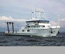
| Description | Length 146 feet/ beam 32 feet. |
| URL | https://www.udel.edu/academics/colleges/ceoe/research/marine-operations/ |
| Platform type | Vessel > Class 3 > Class 3 boats are longer than 40 feet. |
| USGS Center | USGS, Woods Hole Coastal and Marine Science Center (WHCMSC) |
| Owner |
University of Deleware
Lewis, DE
|
| Field activity | Center | Survey location and description |
|---|---|---|
| 2012-007-FA | WHCMSC | Mid-Atlantic Slope |
| 2015-002-FA | WHCMSC | Georges Bank, United States, North America, North Atlantic |
| 2015-005-FA | WHCMSC | Atlantic margin between Alvin Canyon and Cape Hatteras |
| 2016-002-FA | WHCMSC | U.S. mid-Atlantic inner continental shelf to shelf edge |
| 2017-001-FA | WHCMSC | Atlantic margin, Hatteras to Baltimore Canyon, shelf-break to 1500 m water depth |
| 2017-002-FA | WHCMSC | Mid-Atlantic outer shelf and upper continental slope, Hatteras to Wilmington Canyons |
| 2017-671-FA | PCMSC | South Carolina, United States, Atlantic Ocean |
| 2018-002-FA | WHCMSC | Mid-Atlantic margin, 35 nm south of Hudson Canyon to approximately Cape Hatteras, 100 m to 3500 m water depth |