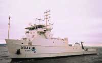
| 12DCM02 |
SPCMSC |
Baltimore and Norfolk Canyons, Mid-Atlantic Bight |
| 2003-046-FA |
WHCMSC |
Long Bay, South Carolina, United States, North America, North Atlantic; |
| 2004-010-FA |
WHCMSC |
Stellwagen Bank, Gulf of Maine, Massachusetts, United States, North America, North Atlantic; |
| 2004-044-FA |
WHCMSC |
Charleston, South Carolina, United States, North America, North Atlantic; |
| 2005-044-FA |
WHCMSC |
Charleston, Myrtle Beach, South Carolina, United States, North America, North Atlantic; |
| 2007-004-FA |
WHCMSC |
Puerto Rico, the U.S. Virgin Islands, and the Dominican Republic, northeast Caribbean, North Atlantic; |
| 2011-027-FA |
WHCMSC |
Shelf edge, Mid-Atlantic states, United States, North Atlantic |
| 2012-010-FA |
WHCMSC |
New Engalnd continental margin, United States, North America, North Atlantic |
| 2015-016-FA |
WHCMSC |
Anegada Passage |
| 2016-033-FA |
WHCMSC |
USVI |
| 2022-629-FA |
PCMSC |
Gulf of Mexico |
| F0112MC |
PCMSC |
Mid-Atlantic (Baltimore and Norfolk Canyons) |
| F0113MC |
PCMSC |
Mid Atlantic Canyons (Norfolk and Baltimore Canyons) |
| F0212MC |
PCMSC |
Baltimore and Norfolk Canyons, Mid-Atlantic Bight |
