| Status | Inactive |
|---|---|
| Photo |  |
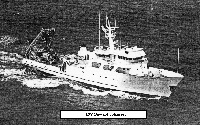
| Description | Length 123 feet, beam 26 feet. |
| Platform type | Vessel > Class 3 > Class 3 boats are longer than 40 feet. |
| USGS Center | USGS, Woods Hole Coastal and Marine Science Center (WHCMSC) |
| Owner |
Harbor Branch Foundation
Fort Pierce, FL
|
| Field activity | Center | Survey location and description |
|---|---|---|
| 1981-025-FA | WHCMSC | Georges Bank and canyons, United States, North America, North Atlantic; |
| 1982-023-FA | WHCMSC | Georges Bank, Lydonia Canyon, Oceanographer Canyon, Veatch Canyon, United States, North America, North Atlantic; |
| 1982-026-FA | WHCMSC | Hudson Canyon, North Atlantic continental shelf, United States, North America, North Atlantic; |
| 1983-021-FA | WHCMSC | Georges Bank, Lydonia Canyon, Oceanographer Canyon, Veatch Canyon, United States, North America, North Atlantic; |
| 1983-022-FA | WHCMSC | Truxton Swell, Gulf of Maine, United States, North America, North Atlantic; |
| 1984-007-FA | WHCMSC | Georges Bank;Lydonia, Oceanographer, Heel Tapper, Gilbert, Hydrographer, and Veatch Canyons;Continental Slope, United States, North America, North Atlantic; |
| 1984-008-FA | WHCMSC | Boothbay Harbor, Stonington, Maine, Cashes Ledge, Jordan Basin, northern Gulf of Maine, United States, North America, North Atlantic; |
| 1984-009-FA | WHCMSC | Middle Grounds area, Block Canyon, Atlantis Canyon, Veatch Canyon, mid-Atlantic Bight, North America, North Atlantic; |
| 1984-034-FA | WHCMSC | Cape Canaveral, Florida east coast, United States, North Atlantic; |