Online Links:
Online Links:
| Range of values | |
|---|---|
| Minimum: | 1 |
| Maximum: | 1 |
| Units: | shot |
| Resolution: | 1 |
| Range of values | |
|---|---|
| Minimum: | 258 |
| Maximum: | 9173 |
| Units: | shot |
| Resolution: | 1 |
| Range of values | |
|---|---|
| Minimum: | 2012 |
| Maximum: | 2012 |
| Units: | Calendar year |
| Resolution: | 1 |
| Range of values | |
|---|---|
| Minimum: | 0.167 |
| Maximum: | 3.879 |
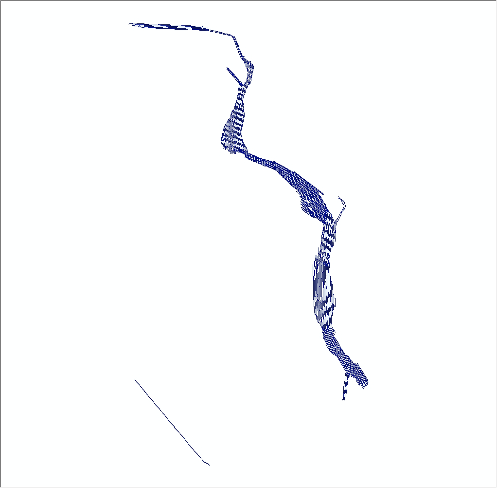
The seismic data associated with these navigation tracklines are used to define the riverbed morphology as part of a mapping project in the Connecticut River. This dataset contains trackline navigation for approximately 230 km of EdgeTech 424 chirp seismic-reflection data collected by the U.S. Geological Survey during USGS survey 2012-024-FA. The seismic data associated with these navigation tracklines are used to define the riverbed morphology.
spatialite_tool -e -shp 2012-024-FA_SWATHPlusTracklines -d ./2012-024-FA-SQLdb.sqlite -t SubxTrack_ln -g geom_subxt -c CP1252 -s 4326 --type LINESTRING
Online Links:
Online Links:
Online Links:
Are there legal restrictions on access or use of the data?Access_Constraints: None
Use_Constraints:Public domain data from the U.S. Government are freely redistributable with proper metadata and source attribution. Please recognize the U.S. Geological Survey as the source of this information.
Neither the U.S. Government, the Department of the Interior, nor the USGS, nor any of their employees, contractors, or subcontractors, make any warranty, express or implied, nor assume any legal liability or responsibility for the accuracy, completeness, or usefulness of any information, apparatus, product, or process disclosed, nor represent that its use would not infringe on privately owned rights. The act of distribution shall not constitute any such warranty, and no responsibility is assumed by the USGS in the use of these data or related materials. Any use of trade, product, or firm names is for descriptive purposes only and does not imply endorsement by the U.S. Government.
| Data format: | Zip file containing trackline navigation for EdgeTech 424 chirp seismic-reflection data collected by the U.S. Geological Survey in the Connecticut River in shapefile format. This also includes associated metadata. in format SHP (version SpatiaLite) polyline shapefile Size: 0.7 |
|---|---|
| Network links: |
https://cmgds.marine.usgs.gov/data/field-activity-data/2012-024-FA/data/seismics/2012-024-FA_SeismicTracklines.zip https://doi.org/10.5066/F7PG1Q7V https://cmgds.marine.usgs.gov/data/field-activity-data/2012-024-FA/ |
This zip file contains data available in shapefile format. The zip file also contains associated metadata. The user must have software to read and process the data file. Free geospatial data viewers can be found online.