| Description |
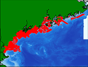
Surficial geologic maps play and important role in understanding the present sea floor and the processes that shape it. Between 1984 and 1991, over 1,700 bottom sample stations were occupied in the northwestern Gulf of Maine. Although the data were originally collected for a variety of research projects, contracts, and graduate student theses, they were eventually compiled as part of a Maine Geological Survey and University of Maine program to map the inner continental shelf of this region. |
