| Online link | https://cmgds.marine.usgs.gov/catalog/pcmsc/SeriesReports/DS_DDS/DS_236/f4100300001d.tif.faq.html |
|---|---|
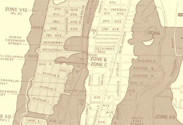
| Description | FEMA's Flood Insurance Rate Map (FIRM) depicts the spatial extent of Special Flood Hazard Areas (SFHAs) and other thematic features related to flood risk assessment. FIRMs also provide a basis for establishing flood insurance coverage premium rates offered through the National Flood Insurance Program (NFIP). These maps were published as paper documents, which have been scanned into image files (TIFF) as part of FEMA's FIRM modernization process. This is one of three scanned maps for the Seaside-Gearhart area - 410030 0001 D, 410032 0001 C, and 410032 0002 C - that were georeferenced for the probabilistic tsunami hazard assessment project. [More] |
| Originators | Federal Emergency Management Administration; Wong, Florence L.; Venturato, Angie J.; and Geist, Eric L. |
