| Description |
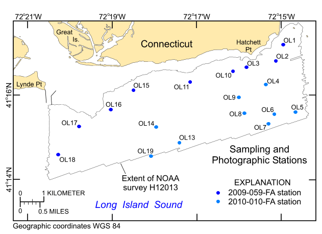
The U.S. Geological Survey (USGS), in cooperation with the National Oceanic and Atmospheric Administration (NOAA) and the Connecticut Department of Energy and Environmental Protection (CT DEEP), is producing detailed geologic maps of the coastal sea floor. Bathymetry and sidescan-sonar imagery, originally collected by NOAA for charting purposes, provide a fundamental framework for research and management activities in Long Island Sound, shows the composition and terrain of the seabed, and provides information on sediment transport and benthic habitat. During April-May 2009 NOAA completed hydrographic survey H12013 offshore of the entrance to the Connecticut River, and during November 2009 and April 2010 bottom photographs and surficial sediment data were acquired as part of two ground-truth reconnaissance surveys of this area. Two interpretive data layers were derived from the multibeam echo-sounder and the ground-truth data used to verify them. For more information on the ground-truth surveys see: http://woodshole.er.usgs.gov/operations/ia/public_ds_info.php?fa=2009-059-FA and http://woodshole.er.usgs.gov/operations/ia/public_ds_info.php?fa=2010-010-FA [More]
|
