| Description |
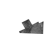
In March 1983, President Ronald Reagan signed a proclamation establishing an Exclusive Economic Zone (EEZ) of the United States extending its territory 200 nautical miles from the coasts of the United States, Puerto Rico, the Northern Mariana Islands, and the U.S. territories and possessions. In 1984, the U.S. Geological Survey (USGS), Office of Marine Geology began a program to map these areas of the EEZ. The U.S. Pacific Coast was the first EEZ region to be mapped and launched GLORIA (Geological LOng-Range Inclined Asdic) mapping program. The area covered by this survey extended from the Mexican to the Canadian borders and from the continental shelf edge, at about the 400-meter bathymetric contour, to 200 nautical miles from the coast. Survey of the U.S. Pacific West Coast EEZ was completed in four consecutive cruises conducted from late April through mid-August 1984. The collected GLORIA data were processed and digitally mosaicked to produce continuous imagery of the seafloor. A total of 36 digital mosaics of an approximate 2 degree by 2 degree (or smaller) area with a 50-meter pixel resolution were completed for the region. [More]
|
