| Description |
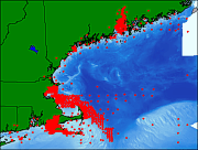
These data, which comprise part of the Smithsonian Institution Master Sediment data file, were abstracted by the staff of the Smithsonian Institution from materials submitted for archival by various groups and individuals. Most of the data in this set were collected by the National Ocean Service (NOS, formerly the U.S. Coast and Geodetic Survey) for the purpose of charting the coastal waters and navigable waterways of the United States. Prior to 1985, the NOS data were released as part of the National Ocean Surveys Hydrographic Database. After 1985, sediment samples collected by NOS during surveys were transferred to the Smithsonian for archival and textural analysis. All of the data in this set were collected post 1985 and have been processed by the Smithsonian. These data were supplied by the National Geophysical Data Center (NGDC), but this data set contains fields that are only a subset of those fields available in the full Smithsonian data set. For example, the data have been clipped to eliminate those stations that were not from the Gulf of Maine, Georges Bank, or the shelf and slope off southeastern New England. Last update of this file was July, 2001. [More]
|
