| Description |
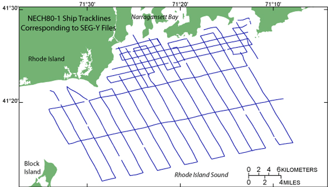
During 1980, a Uniboom seismic-reflection survey was conducted by the U.S. Geological Survey (USGS) in western Rhode Island Sound aboard the Research Vessel NeechoThe cruise consisted of 2 legs and had a total of 8 survey days. Data from this survey were recorded in analog form and archived at the USGS. As a result of recent interest in the geology of Rhode Island Sound and in an effort to make the data more readily accessible while preserving the original paper records, the seismic data from this cruise were scanned and converted to TIFF and PNG images and SEG-Y data files. In order to scan the lines, some of the paper records were cut and scanned in sections. These sections are labeled with lower-case letters and differ from the names of lines in the logbook. Some SEG-Y files were further divided in order for each file to contain continuous data collected at the same ship speed; these line segments have been labeled _1, _2, or _3 after the section label. Navigation data were converted from LORAN-C time delays to latitudes and longitudes that are available in ESRI shapefile format and as eastings and northings in space-delimited text format. [More]
|
