| Description |
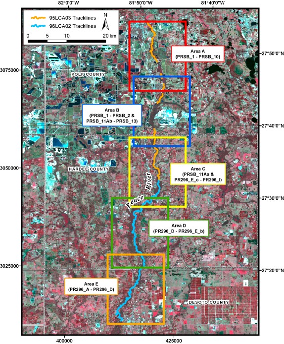
In October and November of 1995 and February of 1996, the U.S. Geological Survey, in cooperation with the Southwest Florida Water Management District, conducted geophysical surveys of the Peace River in west-central Florida from east of Bartow to west of Arcadia. This report serves as an archive of unprocessed digital boomer seismic reflection data, trackline maps, navigation files, GIS files, Field Activity Collection System (FACS) logs, observers' logbooks, and formal FGDC metadata. Filtered and gained digital images of the seismic profiles are also provided. The archived trace data are in standard Society of Exploration Geophysicists (SEG) SEG-Y format (Barry and others, 1975) and may be downloaded and processed with commercial or public domain software such as Seismic Unix (SU). Example SU processing scripts and USGS software for viewing the SEG-Y files (Zihlman, 1992) are also provided. For more information on the seismic surveys see http://walrus.wr.usgs.gov/infobank/j/j395fl/html/j-3-95-fl.meta.html and http://walrus.wr.usgs.gov/infobank/j/j296fl/html/j-2-96-fl.meta.html These data are also available via GeoMapApp (http://www.geomapapp.org/) and Virtual Ocean ( http://www.virtualocean.org/) earth science exploration and visualization applications. [More]
|
