| Online link | https://cmgds.marine.usgs.gov/catalog/spcmsc/of2003-156metadata.faq.html |
|---|---|
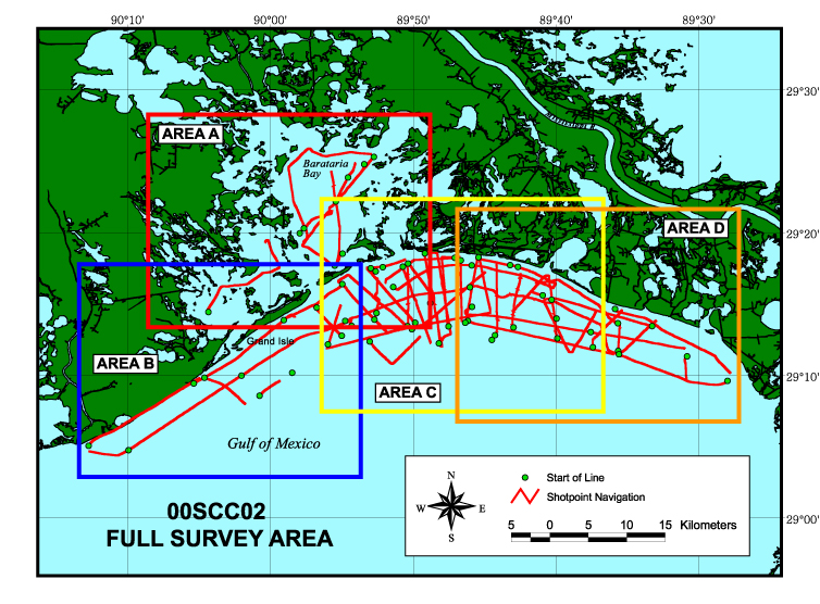
| Description | This archive consists of two-dimensional marine seismic reflection profile data collected in the Barataria Basin of southern Louisiana. These data were acquired in May, June, and July of 2000 aboard the R/V G.K. Gilbert. Included here are data in a variety of formats including binary, American Standard Code for Information Interchange (ASCII), Hyper-Text Markup Language (HTML), shapefiles, and Graphics Interchange Format (GIF) and Joint Photographic Experts Group (JPEG) images. Binary data are in Society of Exploration Geophysicists (SEG) SEG-Y format and may be downloaded for further processing or display. Reference maps and GIF images of the profiles may be viewed with a web browser. The Geographic Information Systems (GIS) information provided here is compatible with Environmental Systems Research Institute (ESRI) GIS software. For more information on the seismic surveys see http://walrus.wr.usgs.gov/infobank/g/g100la/html/g-1-00-la.meta.html and http://walrus.wr.usgs.gov/infobank/g/g500la/html/g-5-00-la.meta.html These data are also available via GeoMapApp (http://www.geomapapp.org/) and Virtual Ocean ( http://www.virtualocean.org/) earth science exploration and visualization applications. [More] |
| Originators | Calderon, Karynna; Dadisman, Shawn V.; Kindinger, Jack L.; Flocks, James G.; Wiese, Dana S.; Kulp, Mark A.; Penland, Shea; Britsch, Louis D.; and Brooks, Gregg R. |
| Field activities | 00SCC02 |
