| Description |
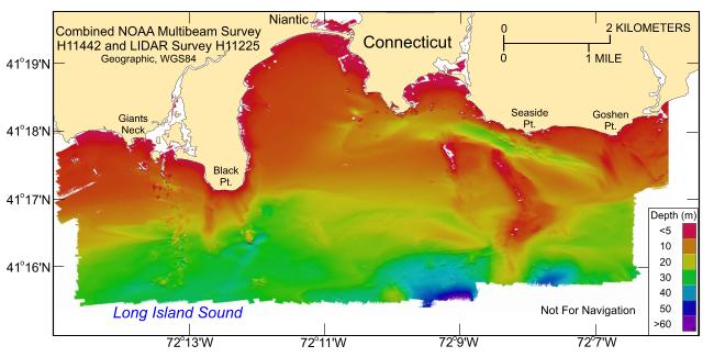
Nearshore areas within Long Island Sound are of great interest to the Connecticut and New York research and management communities because of their ecological, recreational, and commercial importance. However, although advances in multibeam echosounder technology permit the construction of detailed digital terrain models of seafloor topography within deeper waters, limitations inherent with collecting multibeam data make using this technology in shallower waters (<10-m deep) more difficult and expensive. These limitations have often resulted in gaps of no data between multibeam bathymetric datasets and the adjacent shoreline. To address this problem, complete-coverage multibeam bathymetry acquired offshore of New London and Niantic Bay, Connecticut, has been integrated with hydrographic LIDAR acquired along the nearshore. The result is a more continuous seafloor perspective and a much smaller gap between the digital bathymetric data and the shoreline. These datasets are provided as ESRI grid and GeoTIFF formats in order to facilitate access, compatibility, and utility. [More]
|
