Citation:
Citation_Information:
Originator: Nadine Golden
Originator: Guy Cochrane
Originator: Pete Dartnell
Originator: Mercedes Erdey-Heydorn
Originator: Lisa Krigsman
Publication_Date: 2013
Title: C0212SC_video_observations
Geospatial_Data_Presentation_Form: vector digital data
Series_Information:
Series_Name: Data Series
Issue_Identification: DS 781
Publication_Information:
Publication_Place: Reston, VA
Publisher: U.S. Geological Survey
Online_Linkage: https://doi.org/10.3133/ds781
Larger_Work_Citation:
Citation_Information:
Originator: Nadine E. Golden
Publication_Date: 2012
Title: California State Waters Map Series Data Catalog
Geospatial_Data_Presentation_Form: database
Series_Information:
Series_Name: Data Series
Issue_Identification: DS 781
Publication_Information:
Publication_Place: Reston, VA
Publisher: U.S. Geological Survey
Online_Linkage: https://doi.org/10.3133/ds781
Description:
Abstract:
This part of DS 781 presents video observations from cruise C0212SC in southern California. The vector data file is included in "c0212sc_video_observations.zip," which is accessible from
https://pubs.usgs.gov/ds/781/video_observations/data_catalog_video_observations.html.
In 2006 and 2009, the seafloor in central California was mapped by California State University, Monterey Bay, Seafloor Mapping Lab (CSUMB) and by the U.S. Geological Survey (USGS), using both multibeam echosounders and bathymetric sidescan sonar units. These mapping missions combined to collect bathymetry and acoustic-backscatter data from about the 10-m isobath to out beyond the 3-nautical-mile limit of California's State Waters. To validate the interpretations of sonar data in order to turn it into geologically and biologically useful information, the USGS ground-truth surveyed the data by towing camera sleds over specific locations throughout the region. During the 2012 ground-truth cruise, the camera sled housed two video cameras (one forward looking and the other vertical looking), a high-definition video camera, and an 8-megapixel digital still camera. The video was fed in real time to the research vessel, where USGS and NOAA scientists recorded both the geologic and biologic character of the seafloor into programmable keypads once every minute. In addition to recording the seafloor characteristics, a digital still photograph was captured once every 30 seconds. This ArcGIS shape file includes the position of the camera, the time each observation was started, and the visual observations of geologic and biologic habitat.
These data are intended for science researchers, students, policy makers, and the general public. The data can be used with geographic information systems (GIS) software to display geologic and oceanographic information.
Supplemental_Information:
Additional information about the USGS field activity from which these data were derived is available online at:
https://cmgds.marine.usgs.gov/fan_info.php?fan=C0212SC
Any use of trade, product, or firm names is for descriptive purposes only and does not imply endorsement by the U.S. Government.
Although this Federal Geographic Data Committee-compliant metadata file is intended to document the data set in nonproprietary form, as well as in Esri format, this metadata file may include some Esri-specific terminology.
Time_Period_of_Content:
Time_Period_Information:
Range_of_Dates/Times:
Beginning_Date: 20120809
Ending_Date: 20120831
Currentness_Reference: ground condition
Status:
Progress: Complete
Maintenance_and_Update_Frequency: none planned
Spatial_Domain:
Bounding_Coordinates:
West_Bounding_Coordinate: -122.347947
East_Bounding_Coordinate: -120.561532
North_Bounding_Coordinate: 37.097404
South_Bounding_Coordinate: 34.502362
Keywords:
Theme:
Theme_Keyword_Thesaurus: USGS Metadata Identifier
Theme_Keyword: USGS:45641106-fd6f-45dd-ba2c-46d48cb0ab30
Theme:
Theme_Keyword_Thesaurus: Global Change Master Directory (GCMD)
Theme_Keyword: Marine Habitat
Theme:
Theme_Keyword_Thesaurus: ISO 19115 Topic Category
Theme_Keyword: biota
Theme_Keyword: geoscientIficinformation
Theme_Keyword: oceans
Theme:
Theme_Keyword_Thesaurus: None
Theme_Keyword: U.S. Geological Survey
Theme_Keyword: USGS
Theme_Keyword: Coastal and Marine Hazards and Resources Program
Theme_Keyword: CMHRP
Theme_Keyword: Pacific Coastal and Marine Science Center
Theme_Keyword: PCMSC
Theme_Keyword: benthic habitat
Theme_Keyword: fisheries
Theme_Keyword: video sled observations
Theme_Keyword: North Pacific Ocean
Theme_Keyword: Northern Pacific Ocean
Theme:
Theme_Keyword_Thesaurus: Marine Realms Information Bank (MRIB) keywords
Theme_Keyword: video observation
Theme_Keyword: photographic sampling
Theme_Keyword: seabed
Theme:
Theme_Keyword_Thesaurus: USGS Thesaurus
Theme_Keyword: ecosystems
Theme_Keyword: videos
Theme_Keyword: underwater photography
Theme_Keyword: sea-floor characteristics
Theme:
Theme_Keyword_Thesaurus: Coastal and Marine Ecological Classification Standard (CMECS)
Theme_Keyword: Marine Nearshore Subtidal
Theme_Keyword: Marine Offshore Subtidal
Theme_Keyword: Transform Continental Margin
Theme_Keyword: Continental/Island Shelf
Theme_Keyword: Rock Substrate
Theme_Keyword: Unconsolidated Mineral Substrate
Place:
Place_Keyword_Thesaurus: Geographic Names Information System (GNIS)
Place_Keyword: Pigeon Point
Place_Keyword: Scott Creek
Place_Keyword: Santa Cruz
Place_Keyword: Aptos
Place_Keyword: Monterey Canyon
Place_Keyword: Seaside
Place_Keyword: Monterey
Place_Keyword: Point Lobos
Place_Keyword: Point Sur
Place_Keyword: Lafler Rock
Place_Keyword: Gamboa Point
Place_Keyword: Gorda
Place_Keyword: Ragged Point
Place_Keyword: Piedras Blancas
Place_Keyword: Cambria
Place_Keyword: Point Estero
Place_Keyword: Morro Bay
Place_Keyword: Point Buchon
Place_Keyword: Avila Beach
Place_Keyword: Oceano Beach
Place_Keyword: Point Sal
Place_Keyword: Point Purisima
Place_Keyword: Point Arguello
Place_Keyword: Point Conception
Access_Constraints: None
Use_Constraints:
USGS-authored or produced data and information are in the public domain from the U.S. Government and are freely redistributable with proper metadata and source attribution. Please recognize and acknowledge the U.S. Geological Survey as the originator(s) of the dataset and in products derived from these data. This information is not intended for navigation purposes.
Point_of_Contact:
Contact_Information:
Contact_Organization_Primary:
Contact_Organization:
U.S. Geological Survey, Pacific Coastal and Marine Science Center
Contact_Person: PCMSC Science Data Coordinator
Contact_Address:
Address_Type: mailing and physical
Address: 2885 Mission Street
City: Santa Cruz
State_or_Province: CA
Postal_Code: 95060-5792
Country: US
Contact_Voice_Telephone: 831-427-4747
Contact_Electronic_Mail_Address: pcmsc_data@usgs.gov
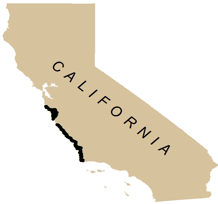
Browse_Graphic:
Browse_Graphic_File_Name:
Browse_Graphic_File_Description:
Location map of video observations along the California coastline.
Browse_Graphic_File_Type: JPEG
Data_Set_Credit:
The authors would like to thank Hank Chezar of the USGS Western Region Coastal and Marine Geology Program (in Santa Cruz and Menlo Park, CA) for field support and equipment support. Pete Dal Ferro, Peter Harkins, Cordell Johnson and Tim Elfers, Gerry Hatcher, and Robert Wyland,
at the USGS Marine Facility (Santa Cruz, CA) contributed field support and logistical support.
Native_Data_Set_Environment:
Microsoft Windows 2000 Version 5.2 (Build 3790) Service Pack 2; ESRI ArcCatalog 9.3.1.3500