Benthic habitats of the coral reef ecosystem off the coast of Pu'uhonua O Honaunau (PUHO) National Historical Park

Metadata also available as - [Outline] - [Parseable text] - [XML]

Frequently anticipated questions:


What does this data set describe?

Title:
Benthic habitats of the coral reef ecosystem off the coast of Pu'uhonua O Honaunau (PUHO) National Historical Park
Abstract:
A benthic habitat polygon coverage has been created of the coral reef ecosystem off the coast of Pu'uhonua O Honaunau (PUHO) National Historical Park on the Kona Coast of Hawai'i. Polygons were hand-digitized from visual interpretation of aerial photography and SHOALS bathymetry data. We also utilized in situ knowledge from towed instruments, underwater photography and videography, and diver and snorkeler observations. The polygons have attributes for Main Structure/Substrate, Dominant Structure/Substrate, Major Biological Cover, Percent of Major Biological Cover, Reef Zone, Unique ID, and measurements of area (m2) of each polygon.
Supplemental_Information:
Additional information about the field activities from which these data were derived are available online at https://cmgds.marine.usgs.gov/fan_info.php?fan=A803HW https://cmgds.marine.usgs.gov/fan_info.php?fan=A204HW https://cmgds.marine.usgs.gov/fan_info.php?fan=A604HW
Any use of trade, product, or firm names is for descriptive purposes only and does not imply endorsement by the U.S. Government.
Although this Federal Geographic Data Committee-compliant metadata file is intended to document the data set in nonproprietary form, as well as in Esri format, this metadata file may include some Esri-specific terminology.
  1. How might this data set be cited?
    Cochran, Susan A., 2007, Benthic habitats of the coral reef ecosystem off the coast of Pu'uhonua O Honaunau (PUHO) National Historical Park: Scientific Investigations Report 2006-5258, U.S. Geological Survey, Western Region Coastal and Marine Geology, Reston, VA.

    Online Links:

  2. What geographic area does the data set cover?
    West_Bounding_Coordinate: -155.919934
    East_Bounding_Coordinate: -155.904457
    North_Bounding_Coordinate: 19.428083
    South_Bounding_Coordinate: 19.404621
  3. What does it look like?
    https://pubs.usgs.gov/sir/2006/5258/images/PUHO_bhabs.gif (GIF)
    gif image of habitat polygons
  4. Does the data set describe conditions during a particular time period?
    Calendar_Date: 31-Jan-2006
    Currentness_Reference:
    publication date
  5. What is the general form of this data set?
    Geospatial_Data_Presentation_Form: vector digital data
  6. How does the data set represent geographic features?
    1. How are geographic features stored in the data set?
      This is a Vector data set. It contains the following vector data types (SDTS terminology):
      • G-polygon (71)
    2. What coordinate system is used to represent geographic features?
      Grid_Coordinate_System_Name: Universal Transverse Mercator
      Universal_Transverse_Mercator:
      UTM_Zone_Number: 5
      Transverse_Mercator:
      Scale_Factor_at_Central_Meridian: 0.999600
      Longitude_of_Central_Meridian: -153.000000
      Latitude_of_Projection_Origin: 0.000000
      False_Easting: 500000.000000
      False_Northing: 0.000000
      Planar coordinates are encoded using coordinate pair
      Abscissae (x-coordinates) are specified to the nearest 0.000004
      Ordinates (y-coordinates) are specified to the nearest 0.000004
      Planar coordinates are specified in meters
      The horizontal datum used is North American Datum of 1983.
      The ellipsoid used is Geodetic Reference System 80.
      The semi-major axis of the ellipsoid used is 6378137.000000.
      The flattening of the ellipsoid used is 1/298.257222.
  7. How does the data set describe geographic features?
    PUHO_BenthicHabitats
    Shapefile attribute table (Source: None)
    FID
    Internal feature number. (Source: Esri) Sequential unique whole numbers that are automatically generated.
    Shape
    Feature geometry. (Source: Esri) Coordinates defining the features.
    ID
    Feature number (Source: Habitat classification scheme)
    Formal codeset
    Codeset Name:ID
    Codeset Source:Habitat digitizing extension
    UNIQUEID
    Unique 4-digit ID used to describe polygon (Source: Habitat classification scheme)
    Formal codeset
    Codeset Name:UNIQUEID
    Codeset Source:Habitat digitizing extension
    M_STRUCT
    Main structure/substrate (Source: Habitat classification scheme)
    Formal codeset
    Codeset Name:M_STRUCT
    Codeset Source:Habitat digitizing extension
    D_STRUCT
    Dominant structure/substrate (Source: Habitat classification scheme)
    Formal codeset
    Codeset Name:D_STRUCT
    Codeset Source:Habitat digitizing extension
    M_COVER
    Major biological cover (Source: Habitat classification scheme)
    Formal codeset
    Codeset Name:M_COVER
    Codeset Source:Habitat digitizing extension
    P_COVER
    Percent of major biological cover (Source: Habitat classification scheme)
    Formal codeset
    Codeset Name:P_COVER
    Codeset Source:Habitat digitizing extension
    ZONE
    Name of cross-shelf geographic zone for each GIS polygon (Source: Habitat classification scheme)
    Formal codeset
    Codeset Name:ZONE
    Codeset Source:Habitat digitizing extension
    AREA
    Area of polygon in sq. meters (Source: GIS calculation software)
    Range of values
    Minimum:26.805
    Maximum:160860.677
    Entity_and_Attribute_Overview:
    Attributes are modified from NOAA/NOS/Biogeography Team's Benthic Habitat Mapping of the U.S. Pacific Territories available online at http://ccma.nos.noaa.gov/products/biogeography/us_pac_terr/
    Entity_and_Attribute_Detail_Citation:
    NOAA National Centers for Coastal Ocean Science (NCCOS). 2005. Shallow-Water Benthic Habitats of American Samoa, Guam, and the Commonwealth of the Northern Mariana Islands (CD-ROM). NOAA Technical Memorandum NOS NCCOS 8, Biogeography Team. Silver Spring, MD.

Who produced the data set?

  1. Who are the originators of the data set? (may include formal authors, digital compilers, and editors)
    • Susan A. Cochran
  2. Who also contributed to the data set?
    Thanks to Pat Chavez and his group from the USGS in Flagstaff for coordinating our acquisition of the SHOALS bathymetric data. The National Park Service provided the aerial photography. Josh Logan (USGS Santa Cruz) created the SHOALS image used as a base layer. His help in field operations and his GIS advice were invaluable throughout the entire process. Paul Jokiel, Ku'ulei Rodgers, Will Smith and others from the University of Hawai'i assisted with field observations and accuracy assessments. A special mahalo goes to Captain Joe Reich, owner of the Alyce C on Moloka'i, whose exceptional navigation and expertise were critical to the success of this project. This work was carried out under the leadership of Project Chief Mike Field (USGS Santa Cruz) as part of a larger Geologic Resource Evaluation for the Kona Coast National Parks.
  3. To whom should users address questions about the data?
    USGS Pacific Coastal and Marine Science Center
    Attn: PCMSC Science Data Coordinator
    2885 Mission St
    Santa Cruz, CA
    USA

    831-427-4747 (voice)
    pcmsc_data@usgs.gov

Why was the data set created?

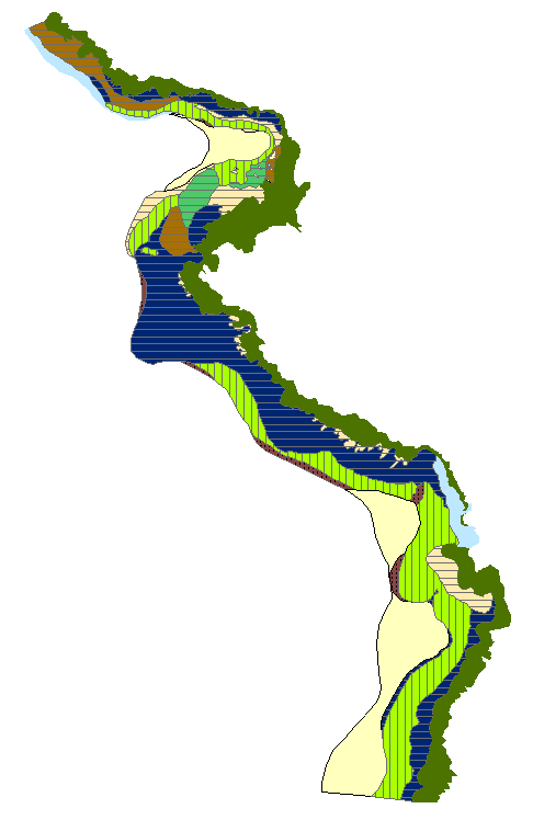
This mapping effort was carried out as a part of a USGS effort to understand geologic processes of coral reef systems in the U.S. and its trust territories. It is intended to provide a baseline inventory of benthic habitat resources of the coral reef system off the coast of Pu'uhonua O Honaunau (PUHO) National Historical Park on the Kona Coast of Hawai'i for use by scientists, managers, and the general public. The data can be used with geographic information systems (GIS) software for research purposes.

How was the data set created?

  1. From what previous works were the data drawn?
    Classification Scheme for Benthic Habitats: U.S. Pacific Territories (source 1 of 6)
    Team, NOAA Biogeography, 2005, Benthic Habitats of the U.S. Pacific Territories Classification Scheme: NOAA\NOS\Biogeography Program, Silver Spring, Maryland.

    Online Links:

    This is part of the following larger work.

    Team, NOAA Biogeography, 2005, Benthic Habitats of the U.S. Pacific Territories: NOAA/NOS/Biogeography Team, Silver Spring, Maryland.

    Online Links:

    Type_of_Source_Media: online
    Source_Contribution:
    Describes the polygon attributes used in the classification scheme
    Coral reef habitat digitizing extension for ArcView 3.2 (source 2 of 6)
    Buja, Ken, Unknown, Coral Reef Digitizing Extension: National Ocean Service, Silver Spring, Maryland.

    Online Links:

    Type_of_Source_Media: Software
    Source_Contribution:
    This ArcView extension was used to digitize GIS coral reef habitat and zone polygons
    Color Aerial Photography (source 3 of 6)
    Coyne, M.S., Monaco, M.E., Anderson, M., Smith, W., Jokiel, P., Battista, T.A., Waddell, J., and Kendall, M.S., 2003, Benthic Habitats of the Main Eight Hawaiian Islands: NOAA/NOS/Biogeography Team, Silver Spring, Maryland.

    Online Links:

    Type_of_Source_Media: online
    Source_Scale_Denominator: 24000
    Source_Contribution:
    Aerial mosaics were used as a base layer for benthic habitat interpretation
    Underwater digital video (source 4 of 6)
    USGS Western Region Coral Reef Project, Unpublished Material, Underwater digital video.

    Type_of_Source_Media: digital videotape
    Source_Contribution: Used to help determine benthic habitat type
    Underwater still photographs (source 5 of 6)
    USGS Western Region Coral Reef Project, Unpublished Material, Underwater still photographs.

    Type_of_Source_Media: CD-ROM
    Source_Contribution: Used to help determine benthic habitat type
    SHOALS bathymetry data (source 6 of 6)
    U.S. Army Corps of Engineers, 2000, SHOALS lidar bathymetry data for the Big Island of Hawai'i: U.S. Army Corps of Engineers, Mobile, Alabama.

    Online Links:

    Type_of_Source_Media: online
    Source_Contribution: Used as a base layer for interpretation of benthic habitats
  2. How were the data generated, processed, and modified?
    Date: 2005 (process 1 of 4)
    Orthorectified mosaicked color aerial photographs and gridded SHOALS bathymetry data in geotif format were used for the interpretation. These were loaded into ArcView 3.2 GIS software along with the NOAA Coral Reef Habitat Digitizing extension. Additional field data used for the interpretation include underwater digital video and photographs, plus diver observations. Habitat boundaries were delineated directly into the digitally referenced GIS. Polygons were saved as a shapefile. Data sources used in this process:
    • All sources were used during the digitizing process
    Date: 2004 (process 2 of 4)
    GIS topologic quality was established using ArcView extension routines that check for: Overlapping polygons Multipart polygons Sliver polygons Void polygons and Adjacency Data sources used in this process:
    • Quality control
    Date: 18-Sep-2018 (process 3 of 4)
    Metadata was edited to fix typos, to bring up to current PCMSC standards, and to add keywords to assist with data discovery. No data were changed. Person who carried out this activity:
    Susan A. Cochran
    USGS Pacific Coastal and Marine Science Center
    Geologist
    2885 Mission St.
    Santa Cruz, CA
    USA

    (831) 460-7545 (voice)
    scochran@usgs.gov
    Date: 19-Oct-2020 (process 4 of 4)
    Edited metadata to add keywords section with USGS persistent identifier as theme keyword. No data were changed. Person who carried out this activity:
    U.S. Geological Survey
    Attn: VeeAnn A. Cross
    Marine Geologist
    384 Woods Hole Road
    Woods Hole, MA

    508-548-8700 x2251 (voice)
    508-457-2310 (FAX)
    vatnipp@usgs.gov
  3. What similar or related data should the user be aware of?

How reliable are the data; what problems remain in the data set?

  1. How well have the observations been checked?
    Vector polygon boundaries were delineated by interpretation of georeferenced color aerial photography and SHOALS bathymetry data. The polygons were attributed using a modified version of the NOS/NOAA coral reef habitat digitizing extension for Esri ArcView (http://ccma.nos.noaa.gov/products/biogeography/digitizer/). Attributes are generated directly in the shapefile and errors are not expected. The shapefiles are free of topology errors. Overall accuracy of the major habitat classifications in these data is greater than 90.27%.
  2. How accurate are the geographic locations?
  3. How accurate are the heights or depths?
  4. Where are the gaps in the data? What is missing?
    Data are complete. Habitat boundaries are based on interpretation of digital imagery data of ground conditions at the time the imagery was collected. Polygon boundaries are subject to change over time.
  5. How consistent are the relationships among the observations, including topology?
    Digitizing was conducted using the "heads up" on screen method. Delineation of habitat boundaries is from interpretation of georeferenced aerial photography and SHOALS bathymetry data. The digital imagery this interpretation is based on are believed to be logically consistent, although not tested.

How can someone get a copy of the data set?

Are there legal restrictions on access or use of the data?
Access_Constraints: None
Use_Constraints:
USGS-authored or produced data and information are in the public domain from the U.S. Government and are freely redistributable with proper metadata and source attribution. Please recognize and acknowledge the U.S. Geological Survey as the originator of the dataset and in products derived from these data. This information is not intended for navigation purposes.
  1. Who distributes the data set? (Distributor 1 of 1)
    USGS Pacific Coastal and Marine Science Center
    Attn: Susan A. Cochran
    2885 Mission St.
    Santa Cruz, CA
    U.S.A.

    831-460-7545 (voice)
    831-427-4748 (FAX)
  2. What's the catalog number I need to order this data set? Downloadable zip file (PUHO_bhabs.zip) contains a polygon shapefile and associated files, including FGDC-compliant metadata
  3. What legal disclaimers am I supposed to read?
    Unless otherwise stated, all data, metadata and related materials are considered to satisfy the quality standards relative to the purpose for which the data were collected. Although these data and associated metadata have been reviewed for accuracy and completeness and approved for release by the U.S. Geological Survey (USGS), no warranty expressed or implied is made regarding the display or utility of the data on any other system or for general or scientific purposes, nor shall the act of distribution constitute any such warranty.
  4. How can I download or order the data?
  5. What hardware or software do I need in order to use the data set?
    To utilize these data, the user must have software capable of uncompressing the WinZip file and importing and viewing an Esri ArcMap shapefile.

Who wrote the metadata?

Dates:
Last modified: 19-Oct-2020
Metadata author:
USGS Pacific Coastal and Marine Science Center
Attn: PCMSC Science Data Coordinator
2885 Mission St
Santa Cruz, CA
USA

831-427-4747 (voice)
pcmsc_data@usgs.gov
Metadata standard:
Content Standard for Digital Geospatial Metadata (FGDC-STD-001-1998)

This page is <https://cmgds.marine.usgs.gov/catalog/pcmsc/SeriesReports/SIR/SIR_2006-5258/PUHO_BenthicHabitats.shp.faq.html>
Generated by mp version 2.9.50 on Tue Sep 21 18:18:26 2021